In early 2021, word came my way that Highways England’s Historical Railway Estate were looking to demolish several former railway structures. One of those structures was very close to me - close enough to make a rather nice early morning walk. So I wandered down to visit a pair of bridge abutments on Stow Road in Wiggenhall St Mary Magdalen that were at risk of demolition in the very near future, to photograph them for posterity (all these pictures have a long-term home on Wikimedia Commons, in full resolution).
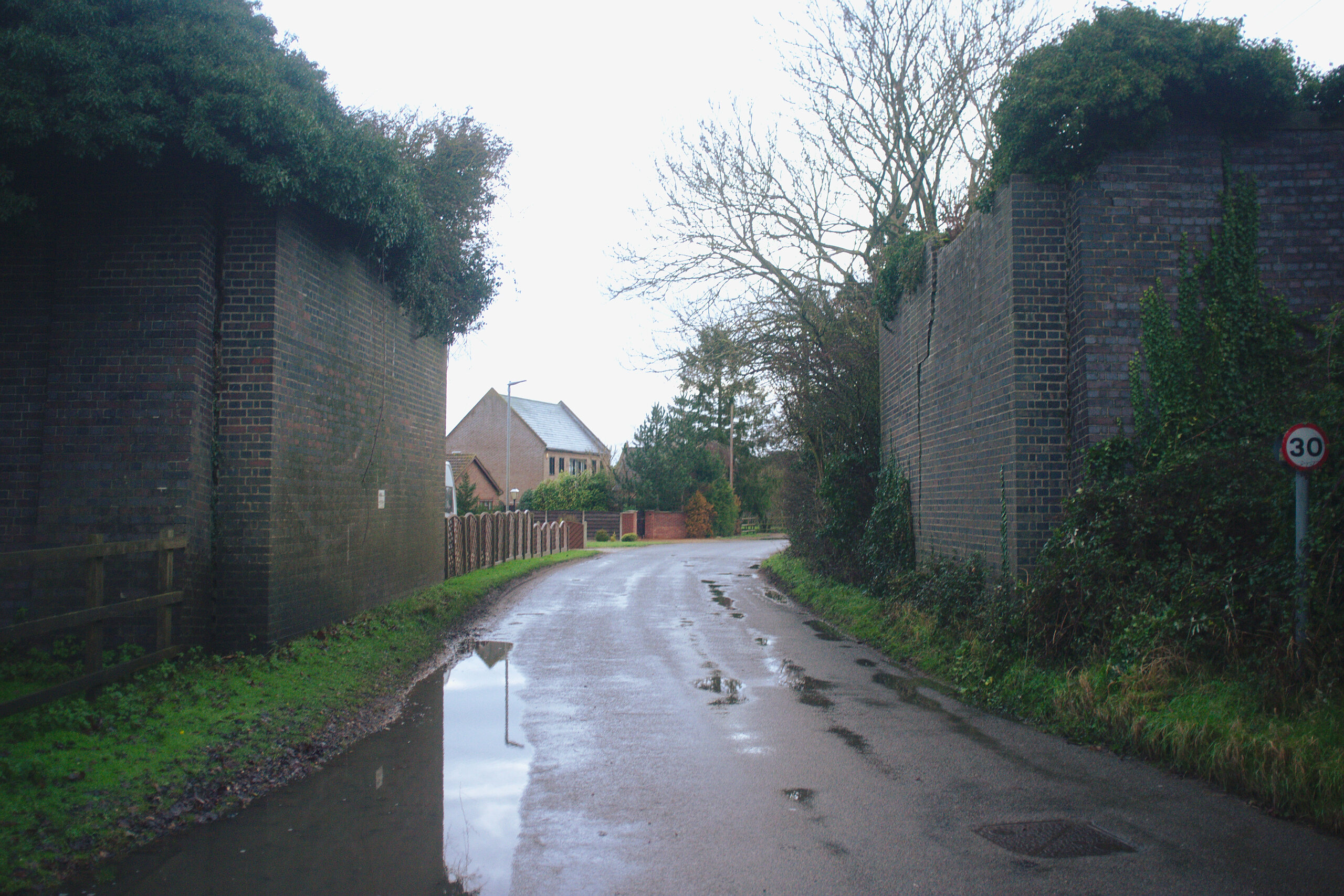
HRE called these two bridge abutments MMR/2333. These used to carry trains from Watlington (previously Magdalen Road), where a branch line left the current Fen Line, to Wisbech. This line closed in 1968. Enough has been written on how short-sighted many of these closures in the 1960s were, and I don’t really need to add to it. But, arguably this one was one of those more short-sighted ones; while many of the smaller stations on the Watlington to Wisbech line seemed to be pointless by the 1960s, one wonders how much less busy the A47 would be if one could hop on a train from King’s Lynn to Wisbech today.
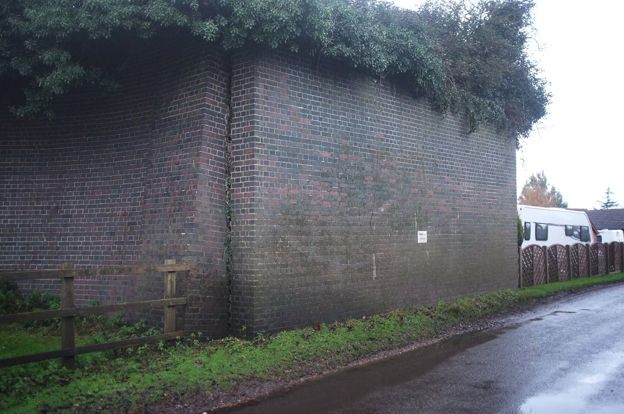
This was one of the abutments, which despite the overgrowth on the top looked to be in reasonable condition.
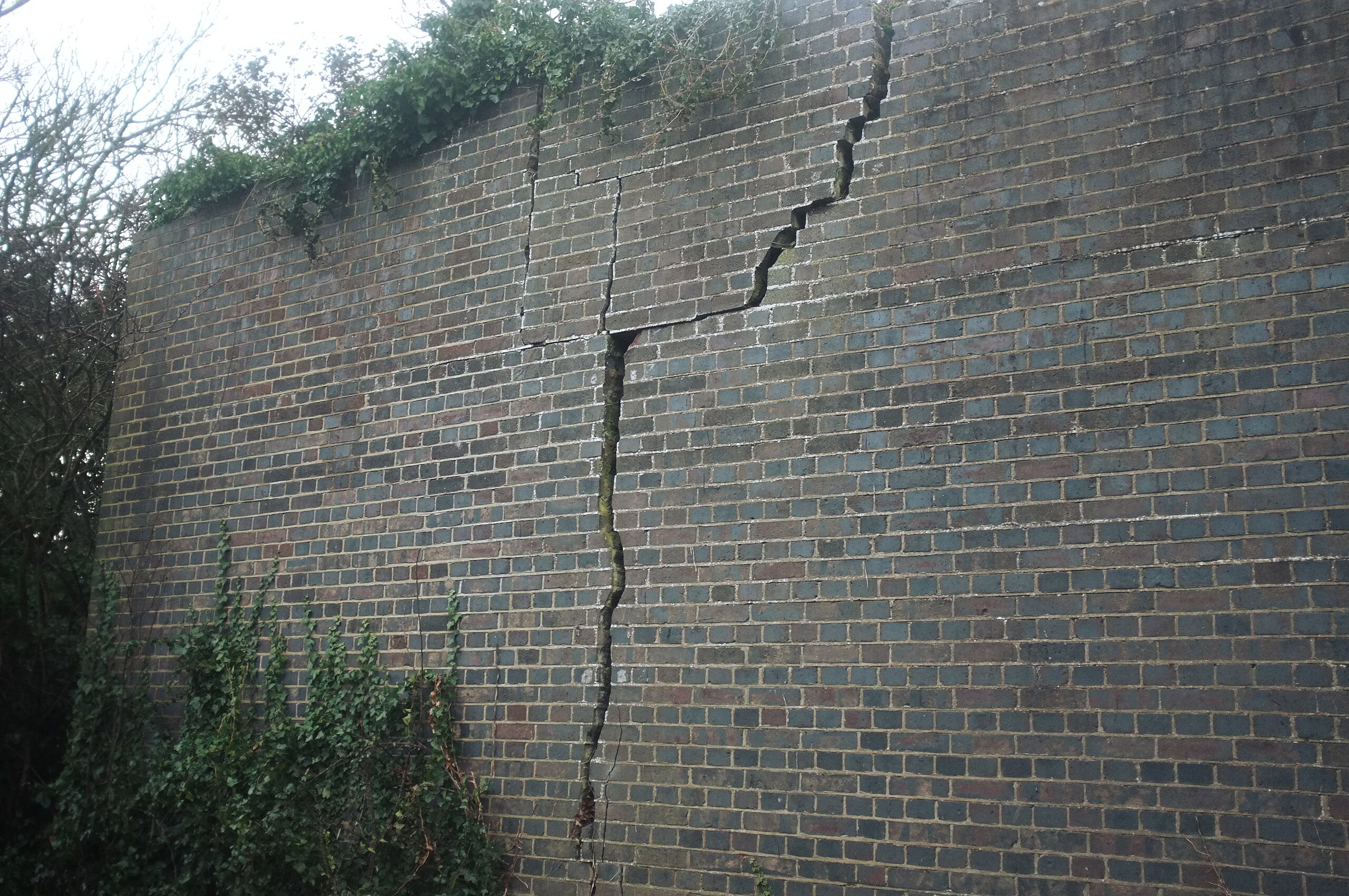
The one on the other side, less so; there was a giant crack in which one could plausibly fit a fist, or a cat.
One could simultaneously agree with the need to preserve remnants of our railways past, and understand why HRE would consider this to be an unnecessary liability. Rather than consider the rights or wrongs of its impending demolition, I took a moment to enjoy some engineering bricks.
Some months later, I decided to revisit them, to see if they were still there.
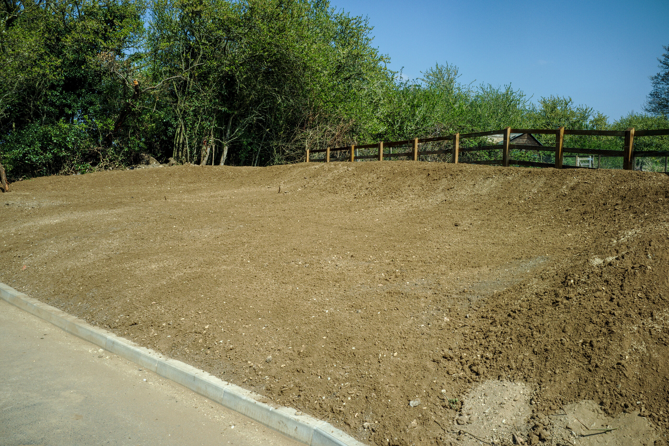
They were not. It’s good to document these things while you can. It is a shame, though, that I visited them while they existed under dim, overcast light on a damp morning, and that I visited the site after demolition on as glorious a blue-skied April day as it is possible to have. It makes the pile of earth look more appealing than the old bridge pillars did.
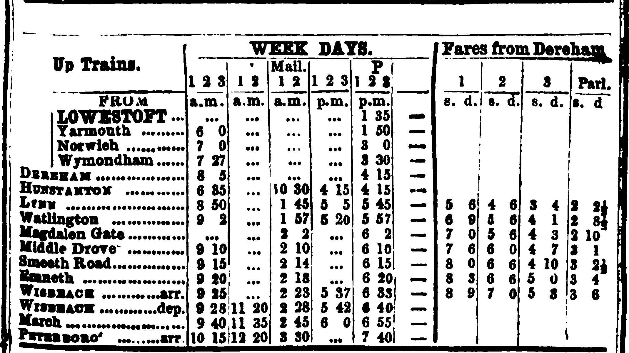
Nearby, would have been the site of Magdalen Gate station. No trace of the station exists today. In fact, there is almost no indication that the station ever existed. A web search mostly returns results from sites that have scraped the Wikipedia article and passed it off as actual information; if you are to believe the article it closed in 1866.
It does show up in timetables from the era where it is claimed to be open (which exposed the interesting detail that it was a request stop back then), so its existence is not entirely mythical. It continues to be marked on maps until the early 20th century; a siding may have persisted here until at least 1910. And the crossing keeper’s house may still exist on Fen Road, so not all trace of it is lost. It is now a private dwelling, so I won’t post photos of that without asking.
Let us head now towards the River Great Ouse. If you are following the alignment of the track, you will find this, which is not railway related, but is pretty cool anyway, and which I missed in all the years I have walked around.
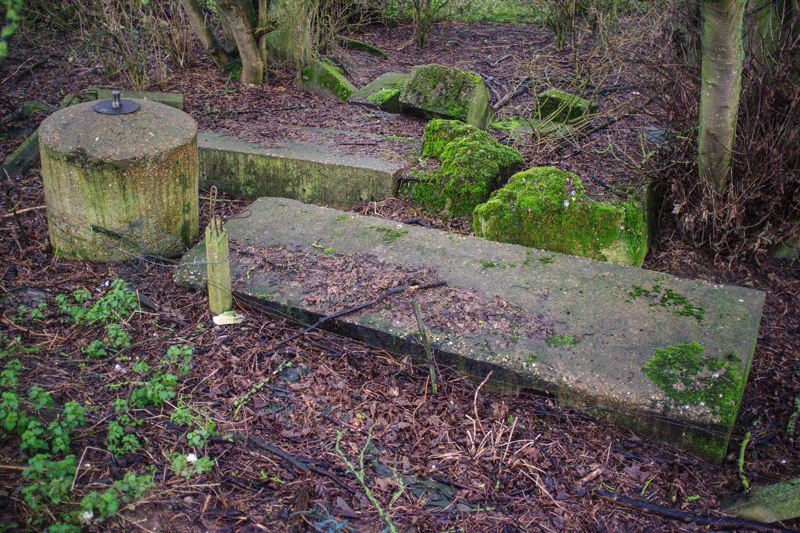
This is a spigot mortar emplacement! Spigot mortars, in particular the Blacker Bombard, were fairly crude weapons to be used by the Home Guard in the event of a German invasion during World War II. I do not know where this one was originally sited. But it is unlikely to be at its exact current location. Perhaps this may have been on the embankment before it was levelled; I don’t know.
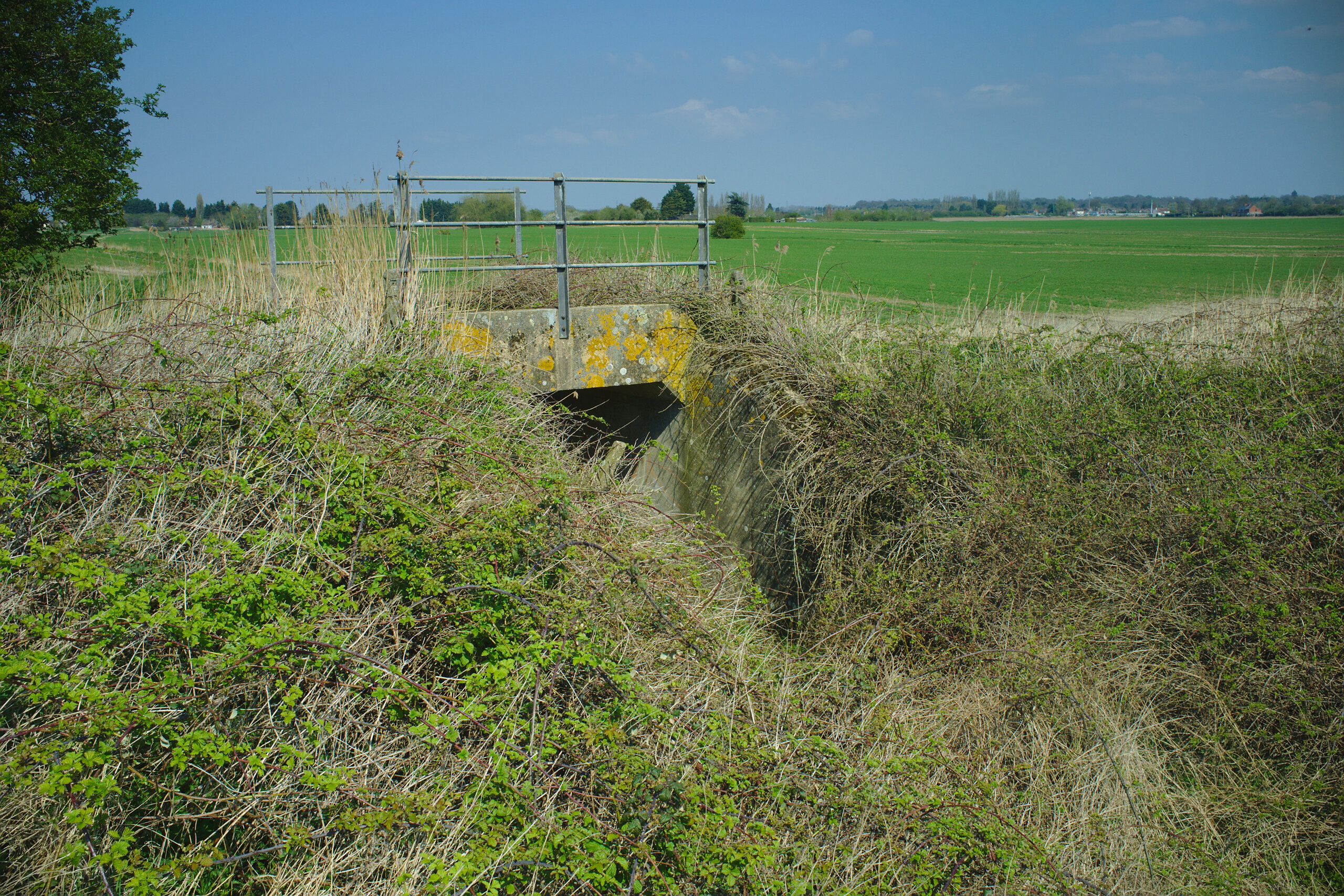
And on the banks of the Ouse, we will find this concrete (or maybe stone) bridge abutment.
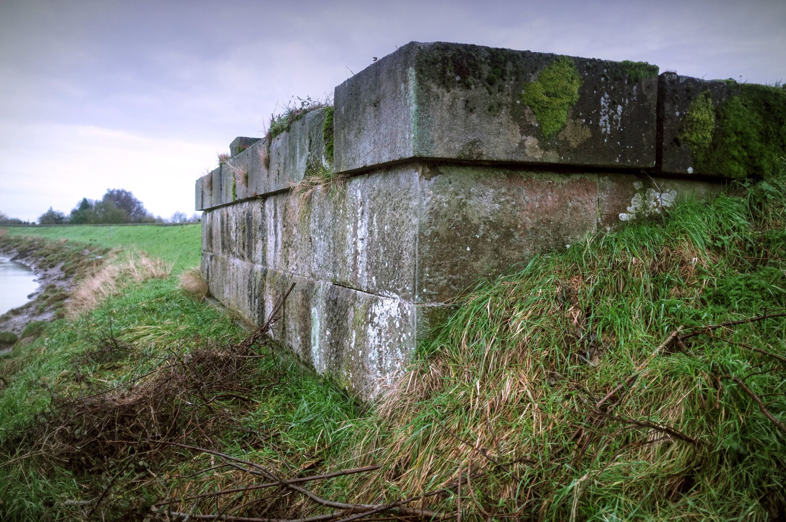
It’s a magnificent thing; my bet is that it could hold a train today. There is, as far as I know, only one photo of this bridge that has been digitised. This one is sometimes mistaken for a photo of the railway bridge; apart from the curvature of the deck that would be impossible for a train to pass over, there is no view of the old railway bridge that could possibly have had the church in the background. The one that can be confirmed as being the correct bridge was found by “Appso” on the King’s Lynn Forums.
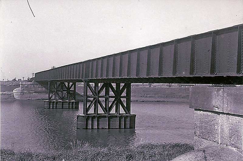
You’ll notice that although this is clearly in the right location, the abutments in this photo look rather more substantial than they do today. Notice how much more stone there is around and below it. I suspect that there has been soil (maybe silt) built up on it over the years, and that underneath that the abutments continue to exist as they were back in the day.
Anyway, some months after I took the first photo above of the abutment, it gained guard rails.
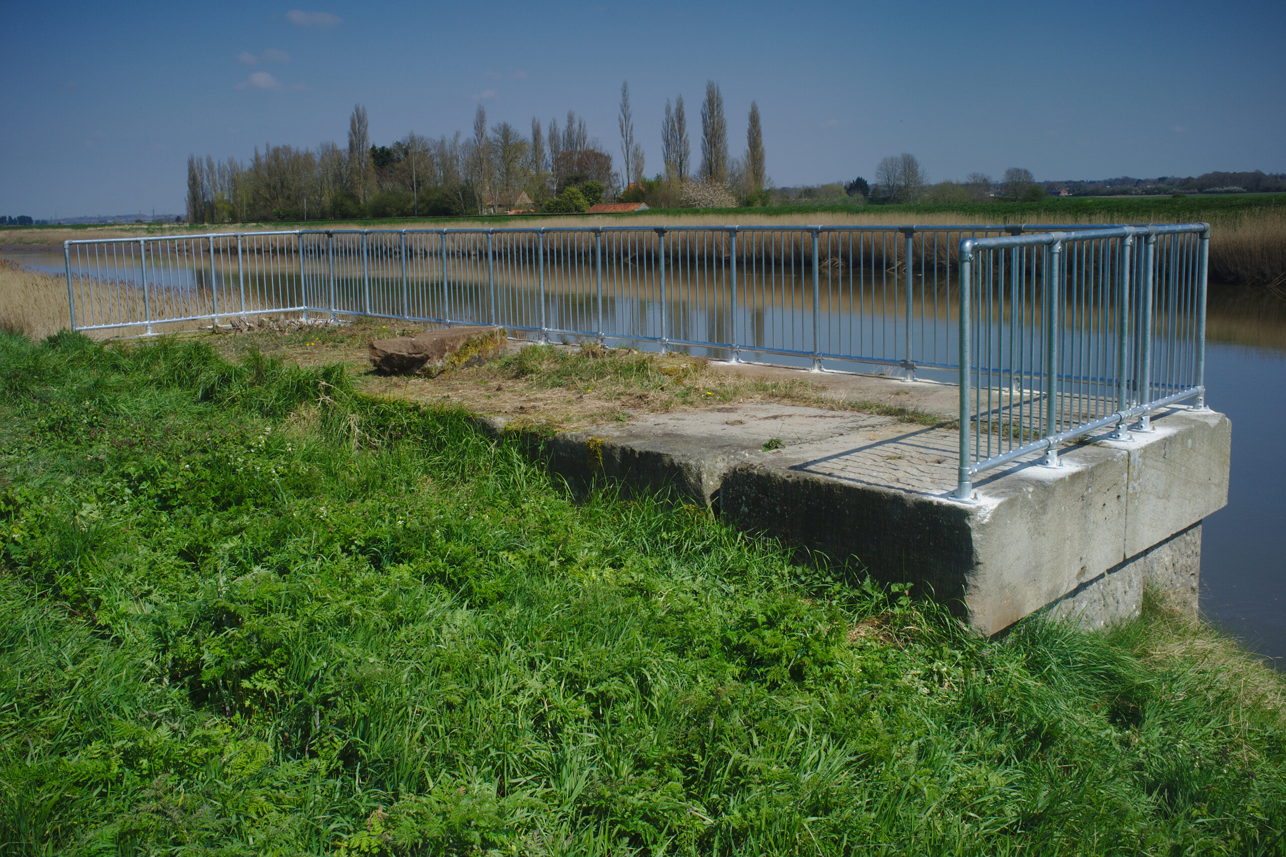
Maybe the intent was to make a nice viewing platform; it is. Or maybe it was put in place by one of those government departments who worry far too much about people falling off things. It is still a lovely peaceful place to observe the Ouse either way.
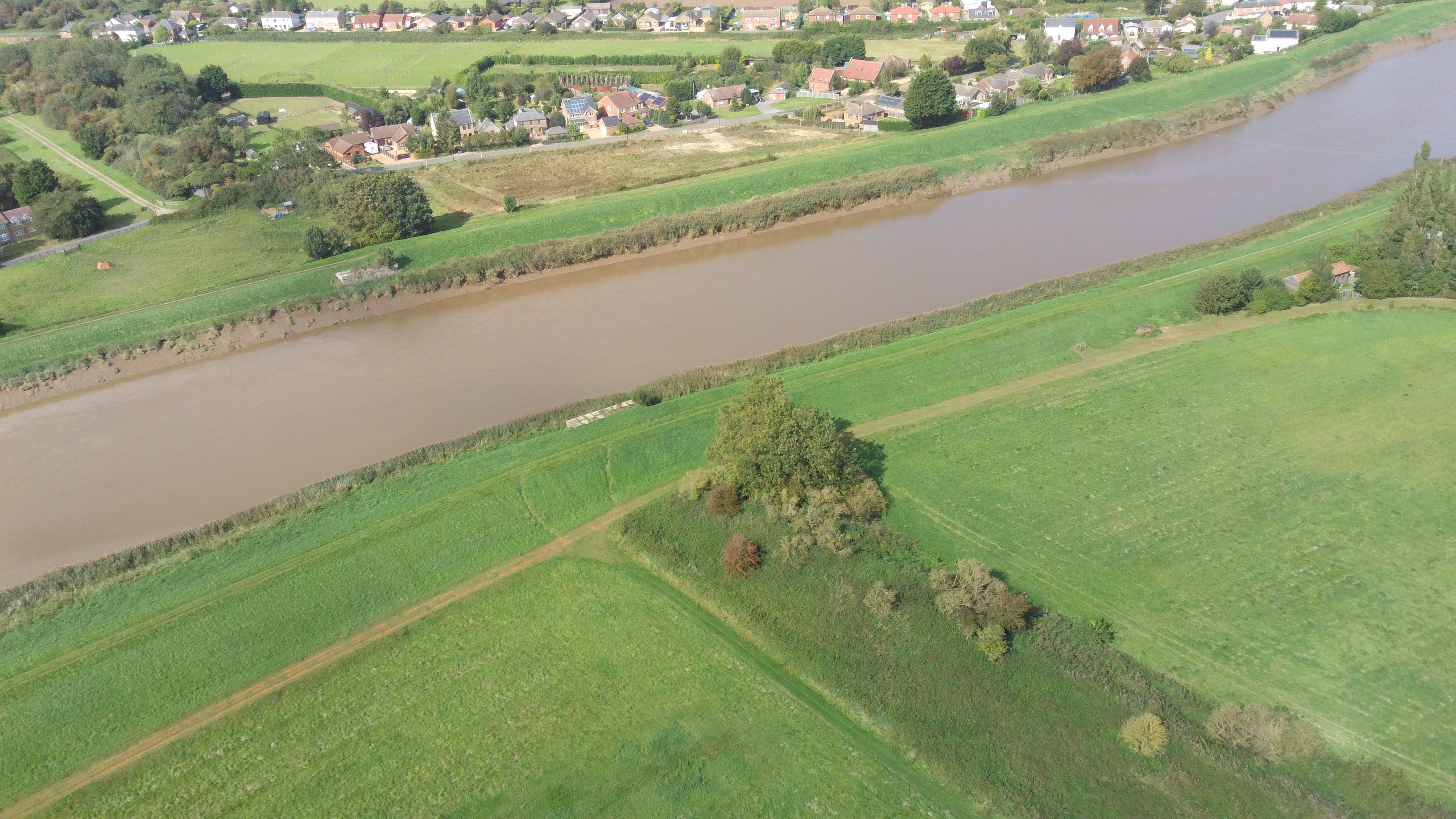
Seen from the air (the Norfolk’s Disused Railways drone), you can see where our bridge crossed the Ouse, and you can also see an embankment leading up to it on the other side of the river.
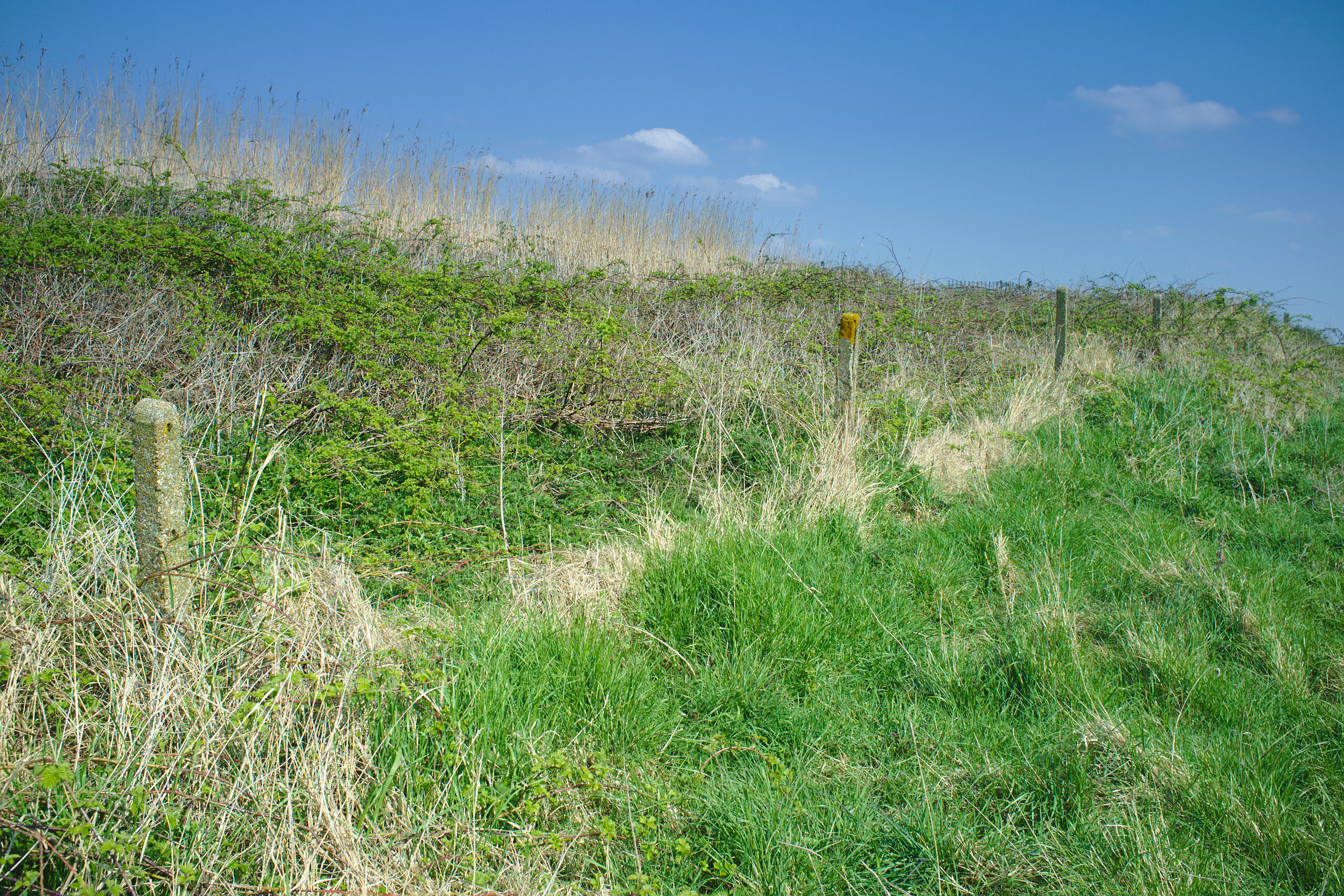
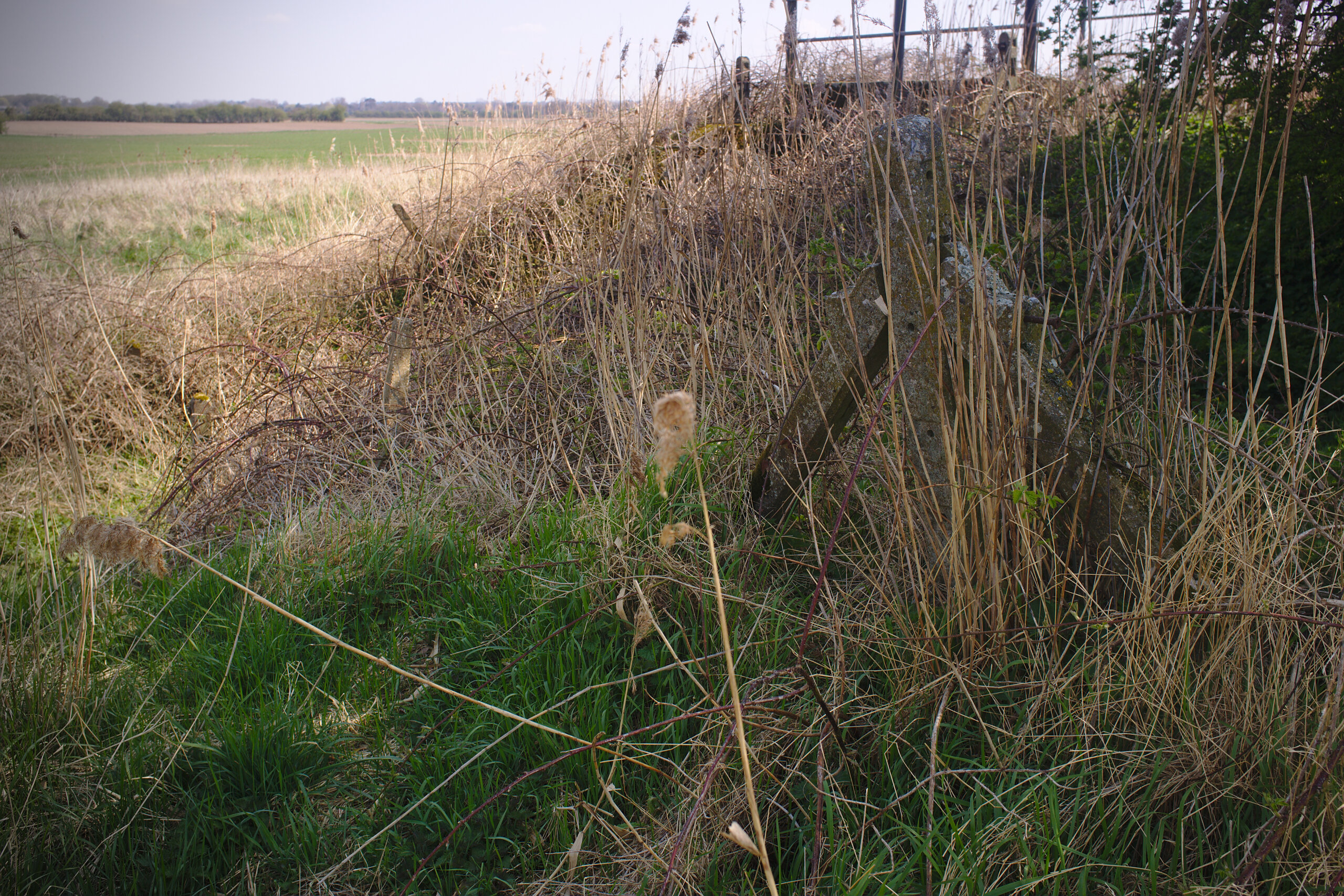
So, let’s head to the other side of the Ouse. This is a stone’s throw away if you have a good arm. Because there’s no bridge this will be about two thirds of a mile; you’ll need to walk down to the road bridge in Magdalen, cross over, and head back up. There’s an identical abutment to the one above which I didn’t photograph, because it looks the same. Instead, head east towards the relief channel and you will notice an embankment. Lining the bottom of this embankment are some concrete fence posts, clearly of railway origin.
…and then you follow the fence posts up the embankment…
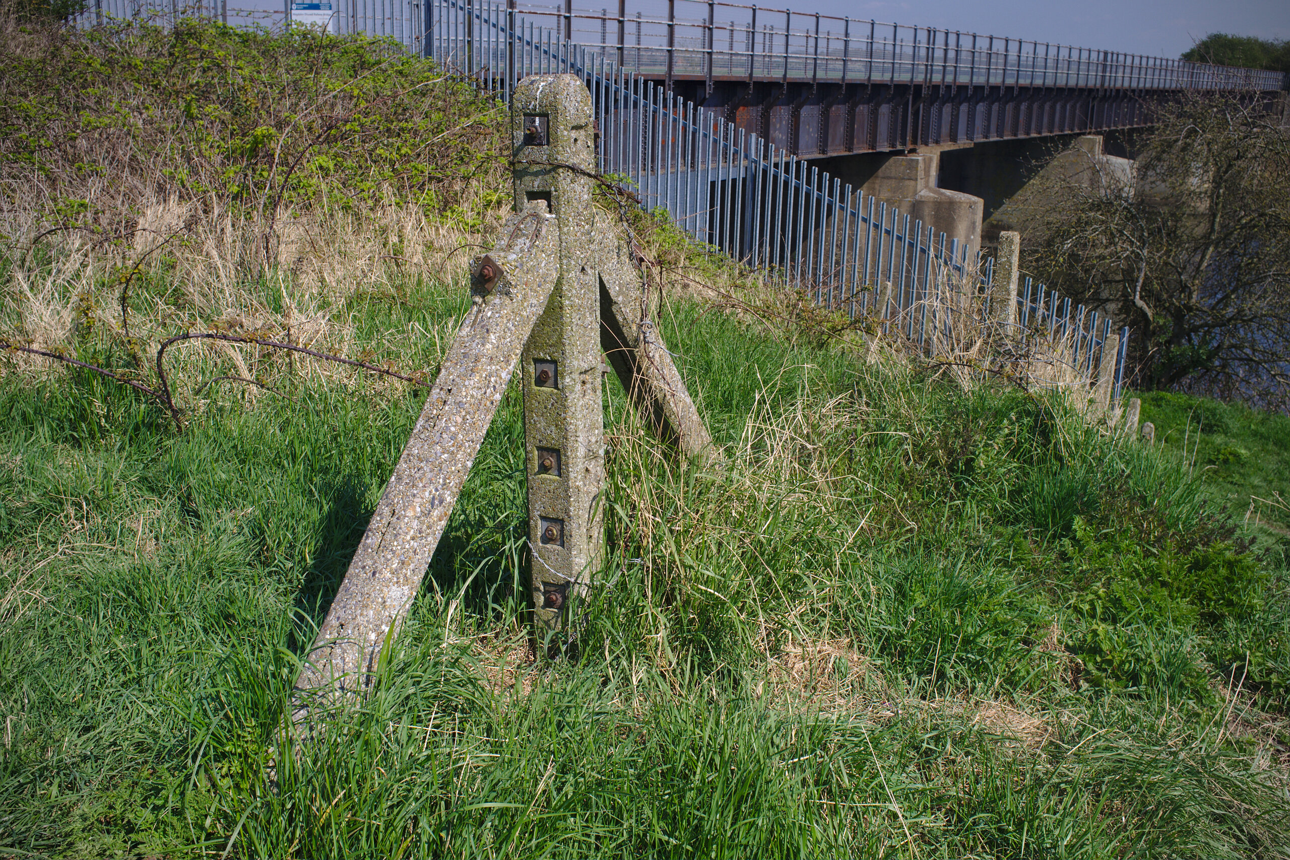
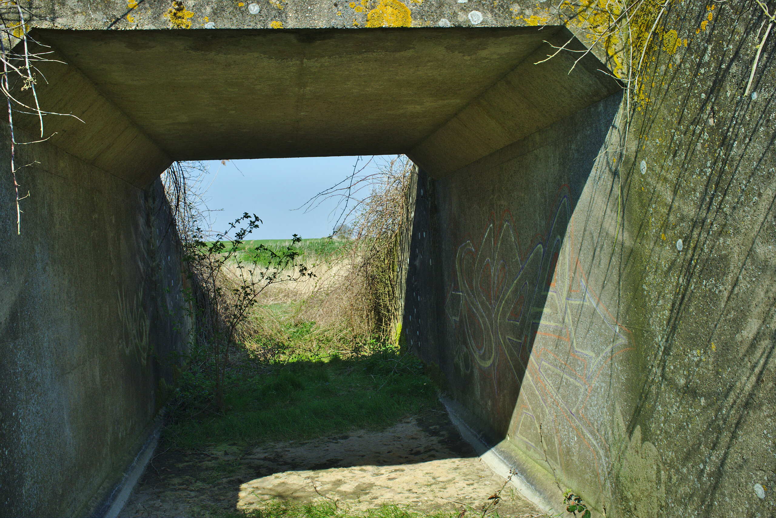
…and find this spectacular, beautifully-preserved railway bridge.
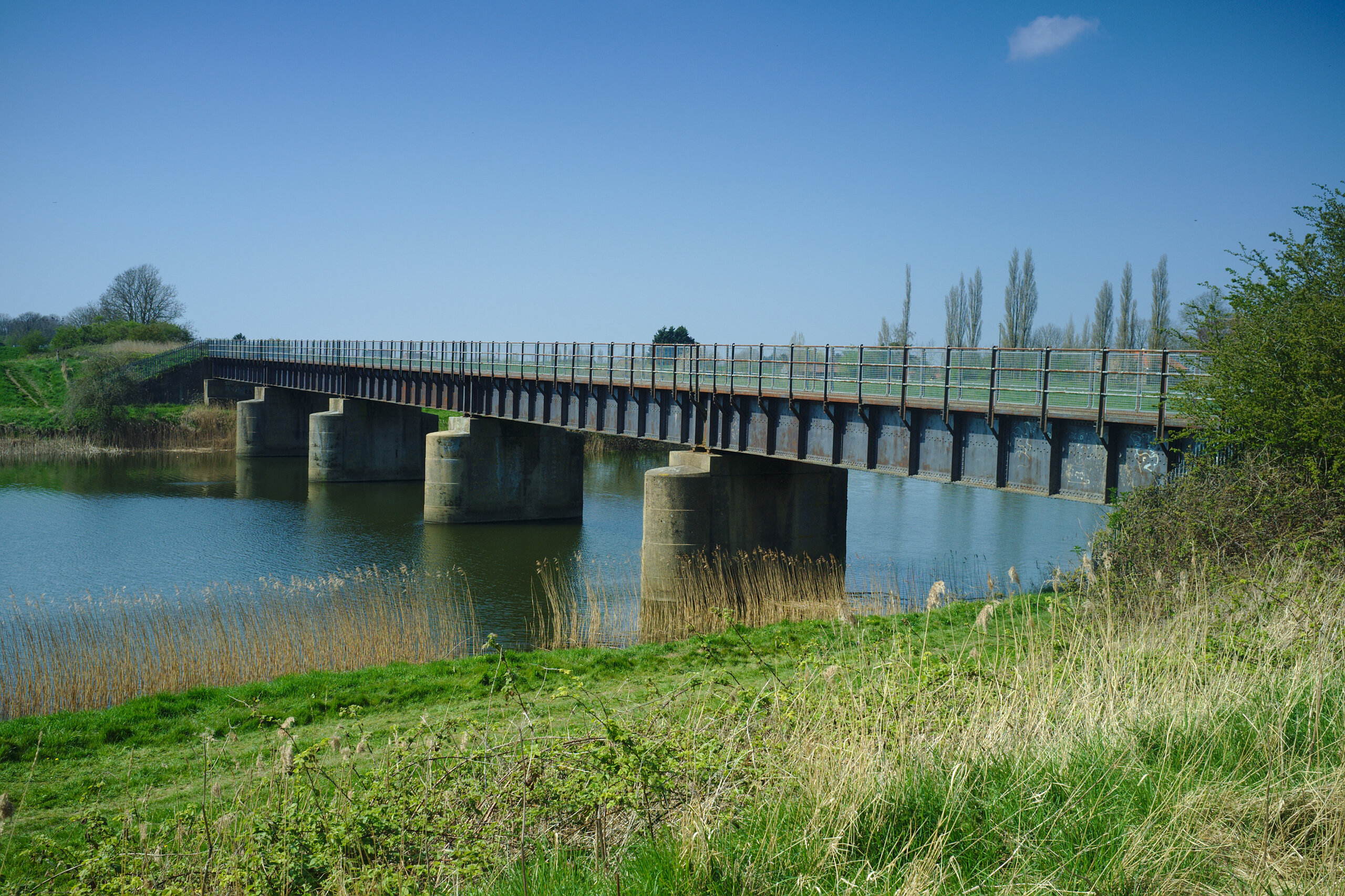
What a view!
I am unsure about the history of this bridge. Its deck seems quite Victorian in style. Yet, the Great Ouse Relief Channel it spans was constructed in the early 1960s, and its concrete piers and abutments seem to be clearly of that era. I speculate, but do not at all know (and would like to know), that the deck may have been transplanted from some other railway that was closed. This bridge only had a very few years in railway service before the line to Wisbech was closed.
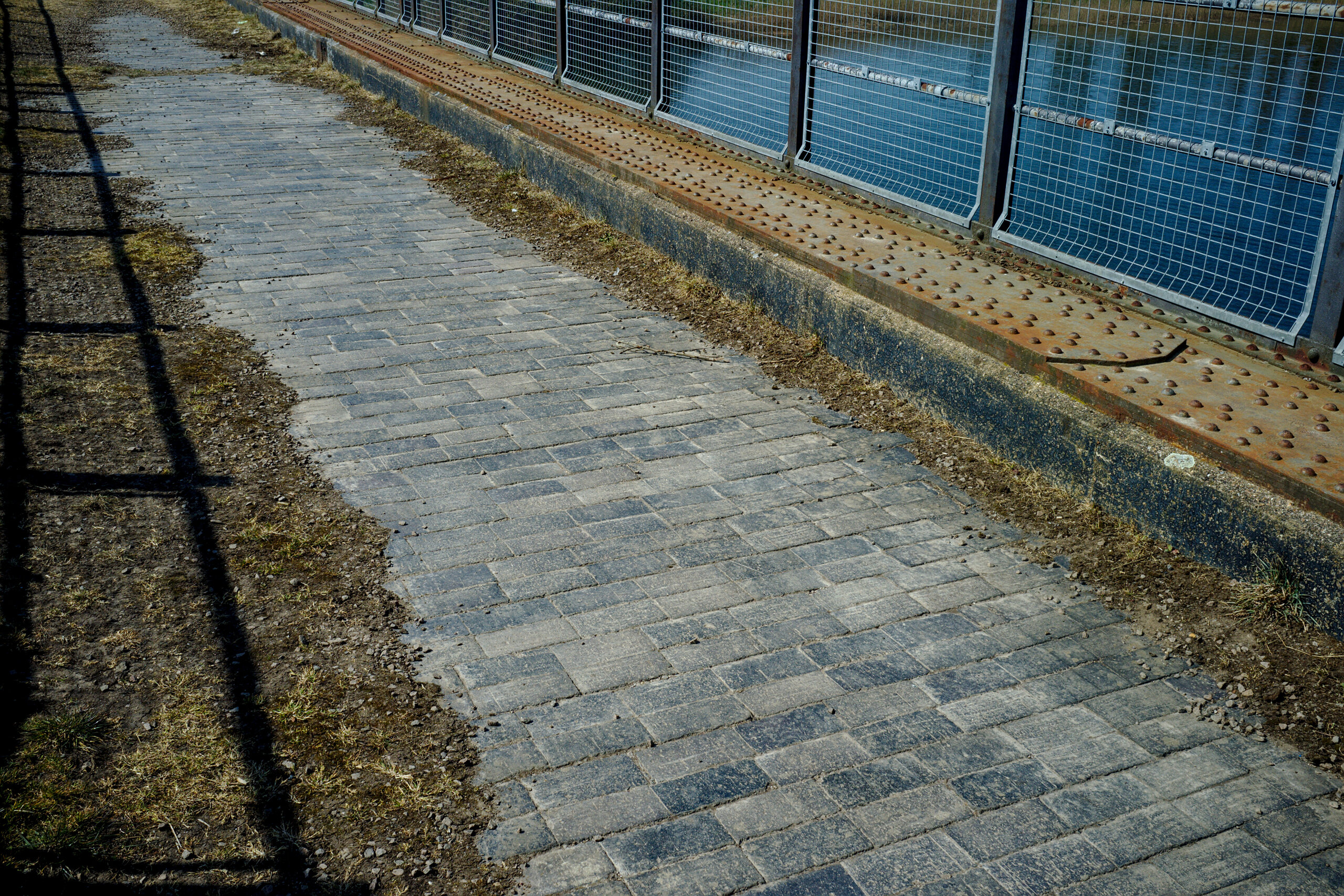
I have been here more times than I could reasonably count. Every time I revisit it, I still love admiring all of its little details. Such as the remnants of track ballast:
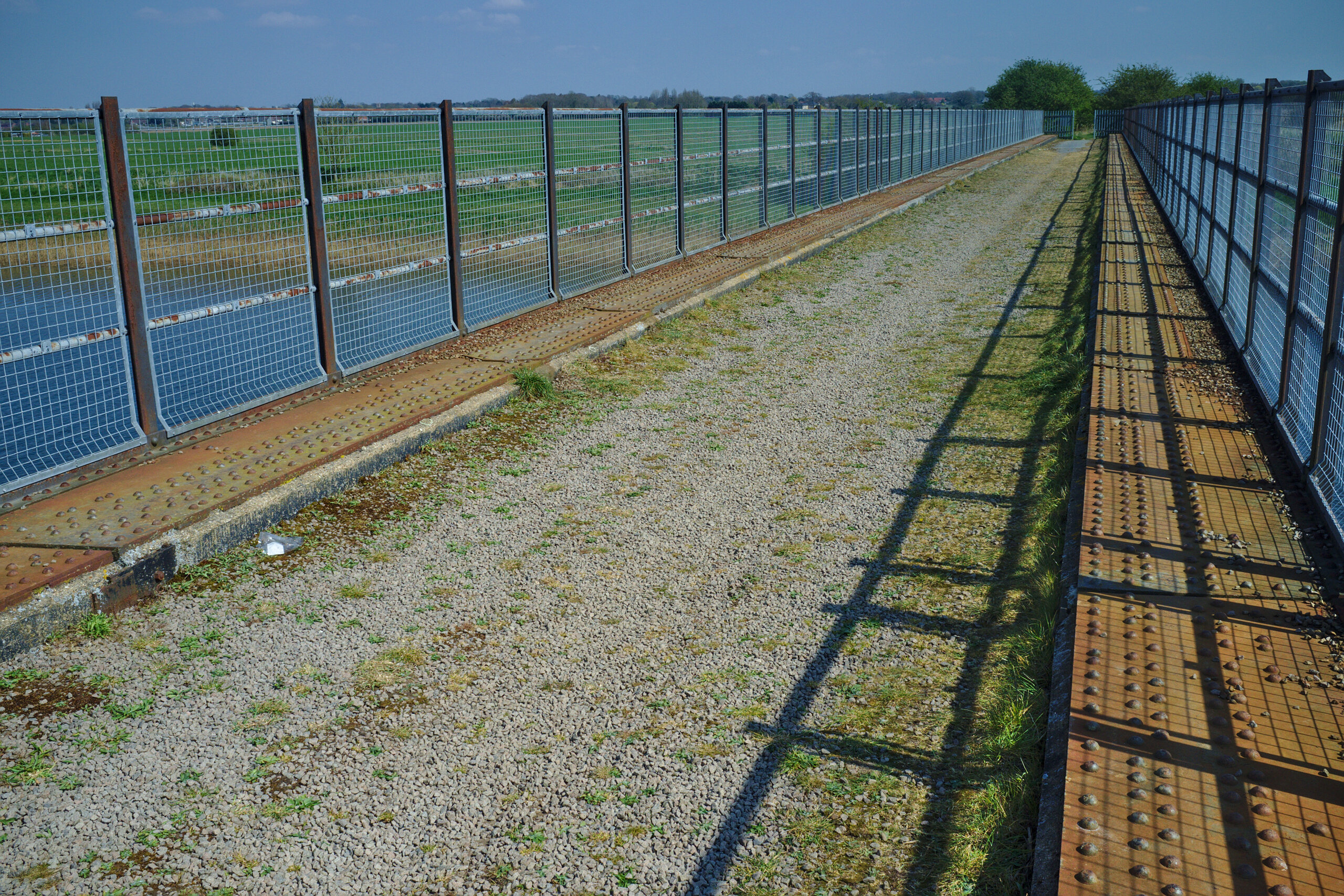
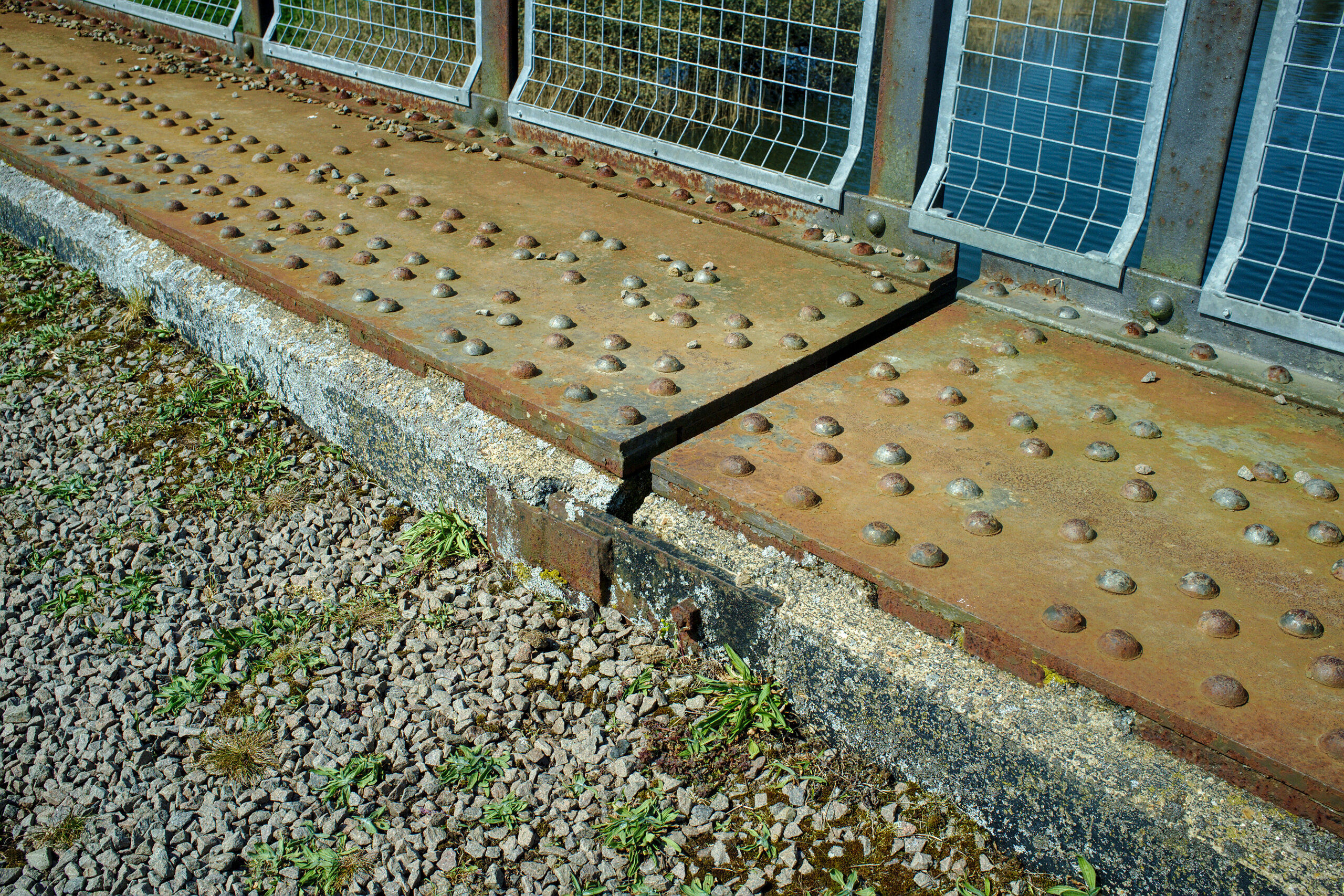
Or, at the eastern end of this bridge, an area where the ballast has been worn away exposing some spectacular stonework:
Or the railings (the silver square fencing is a latter addition, which is again probably the work of some government department that dislikes things falling off other things):
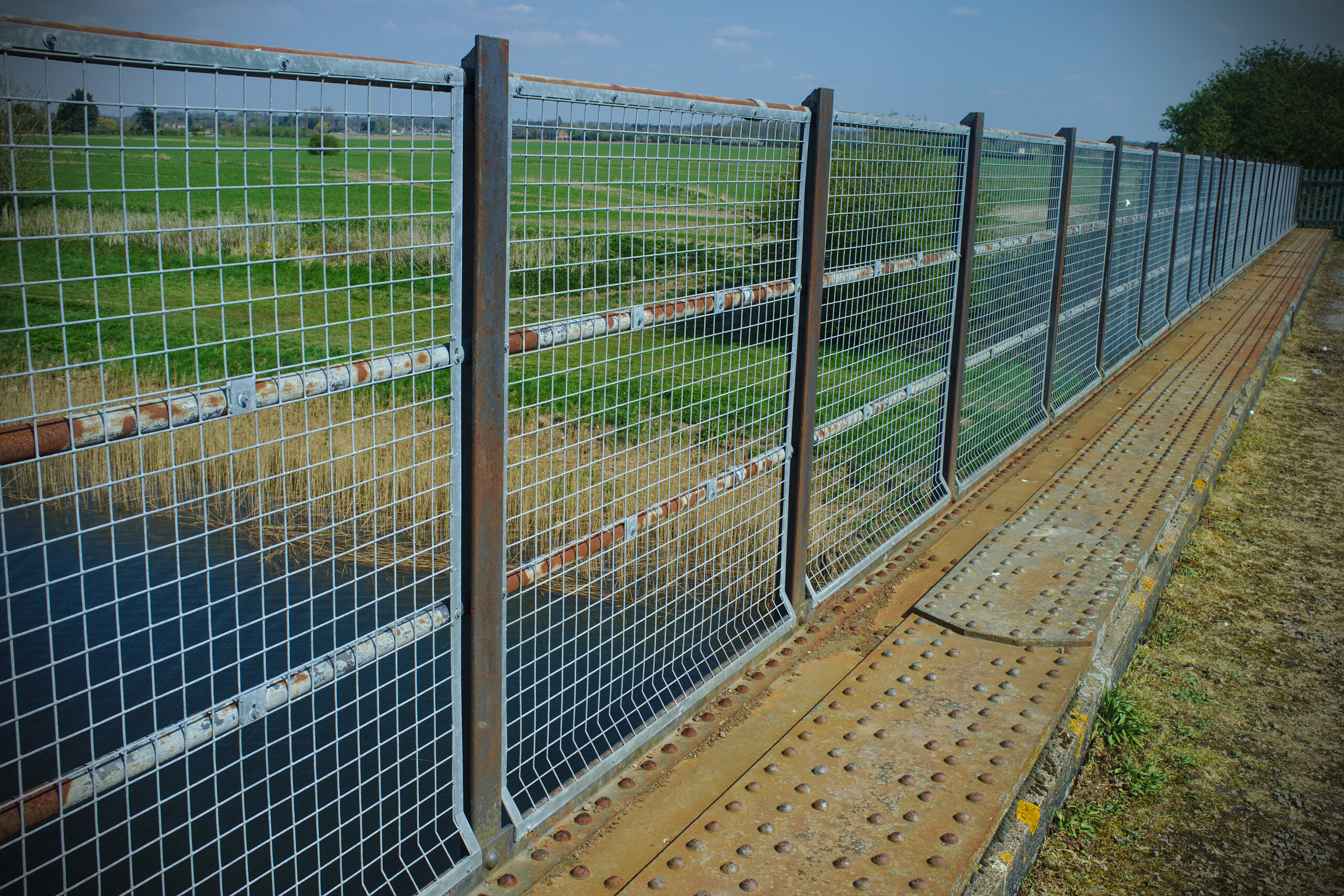
Or the expansion gaps, and the countless hot rivets…
This never gets old!
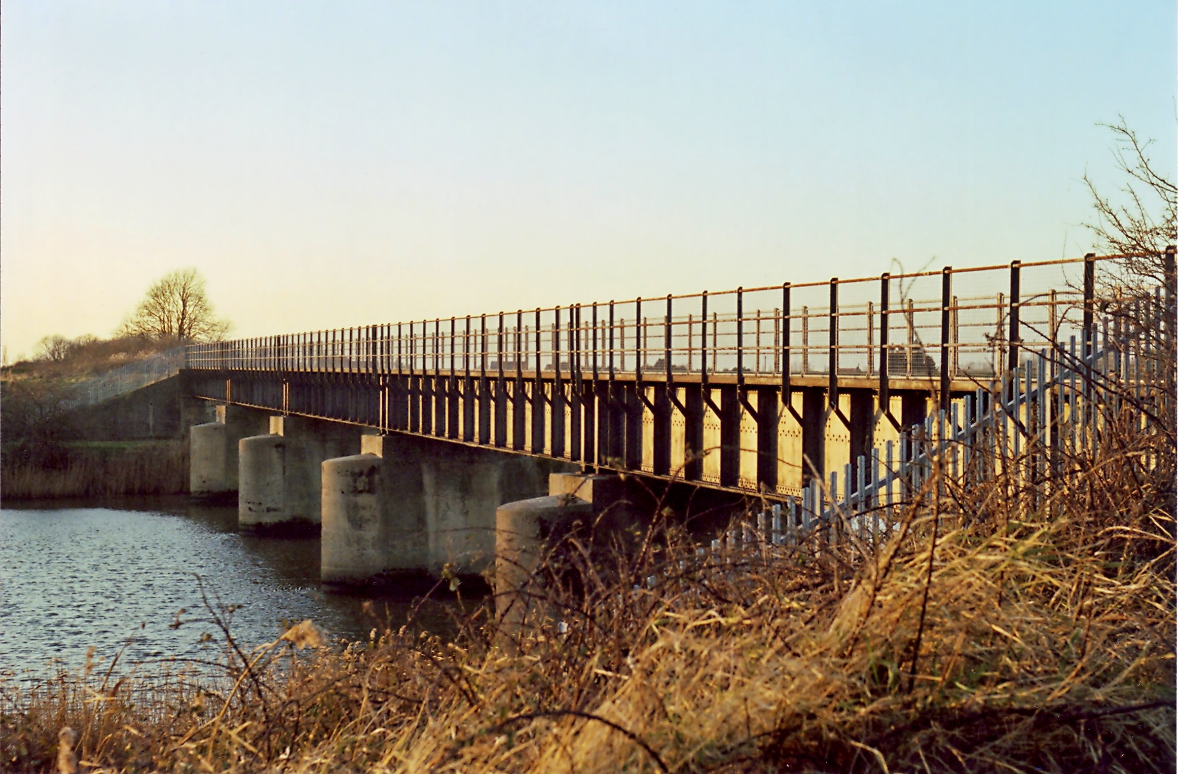
That bridge has been photographed many times; it is visible for miles, and it is a great place for a dog walk. These days you can even get it from the air; for our next report, we’ll hand you over to the Norfolk’s Disused Railways drone.


Yet, just to the East of this is another bridge that is probably less well-known; you could easily miss its existence if you are walking along the bank of the Relief Channel. You can see it if you look really closely at the middle bottom of the second drone photo above. From the ground, it’s rather well-hidden by undergrowth, but again the fence posts give it away…
Do you see it? That’s right, it’s a tiny bridge!
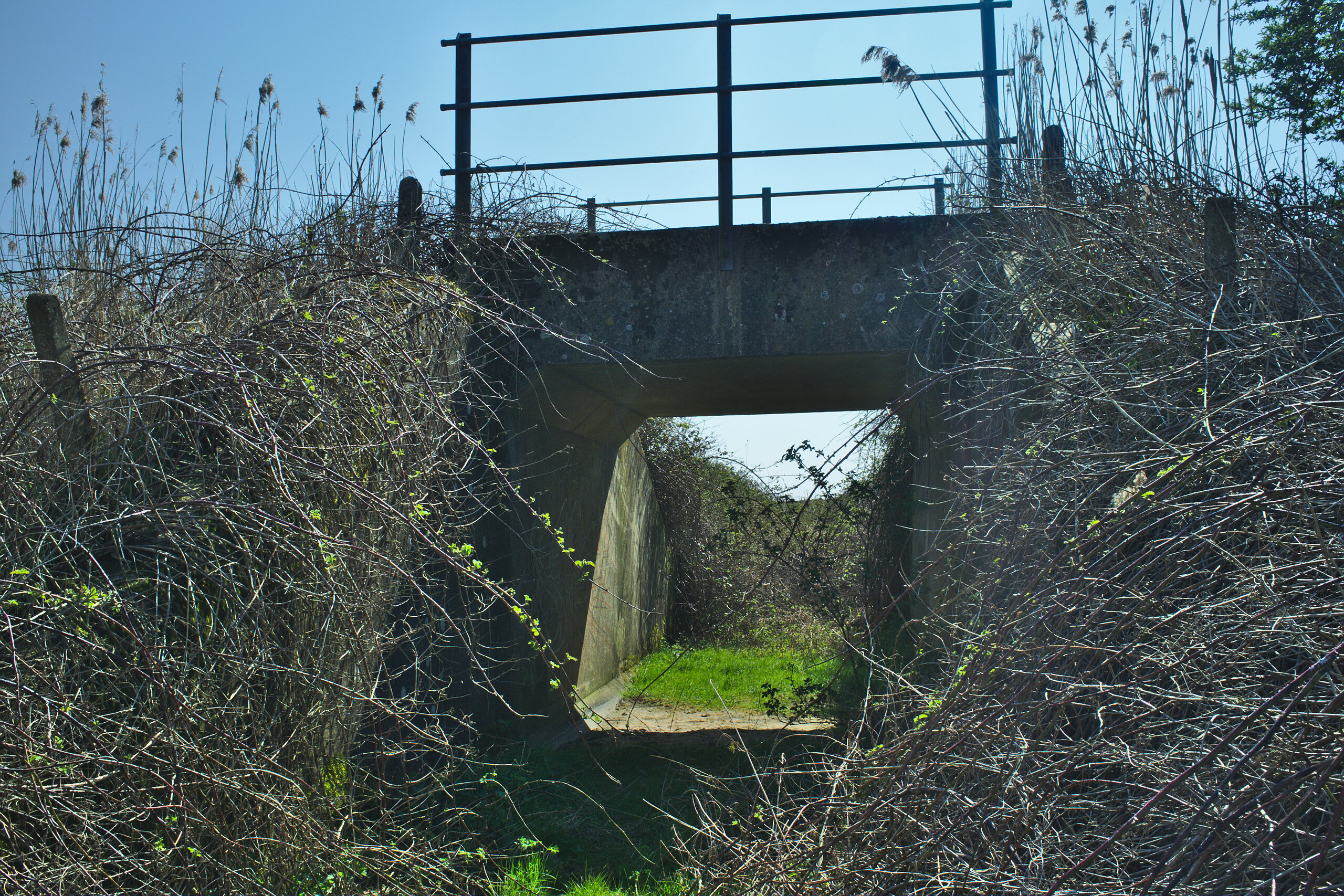
It is also difficult to photograph, because this side of it is usually in the shade, with the sun facing into the camera. The other side is less accessible by foot, but makes for a better-lit photograph.
It looks like someone must have gone to some effort to preserve this bridge and keep it free of weeds on at least one side, and I am grateful for that person. When I first saw this bridge years ago it was completely inaccessible by foot. Now you can get underneath it.
Perfect.
And those were a couple of nice walks. I was pleased I had the foresight to photograph something that is now gone, and I am always pleased to visit my favourite bridge. And it shows that with only a little exploring, open eyes, and an open mind, you can find plenty of railway remnants even in places where one would think they were all long gone.