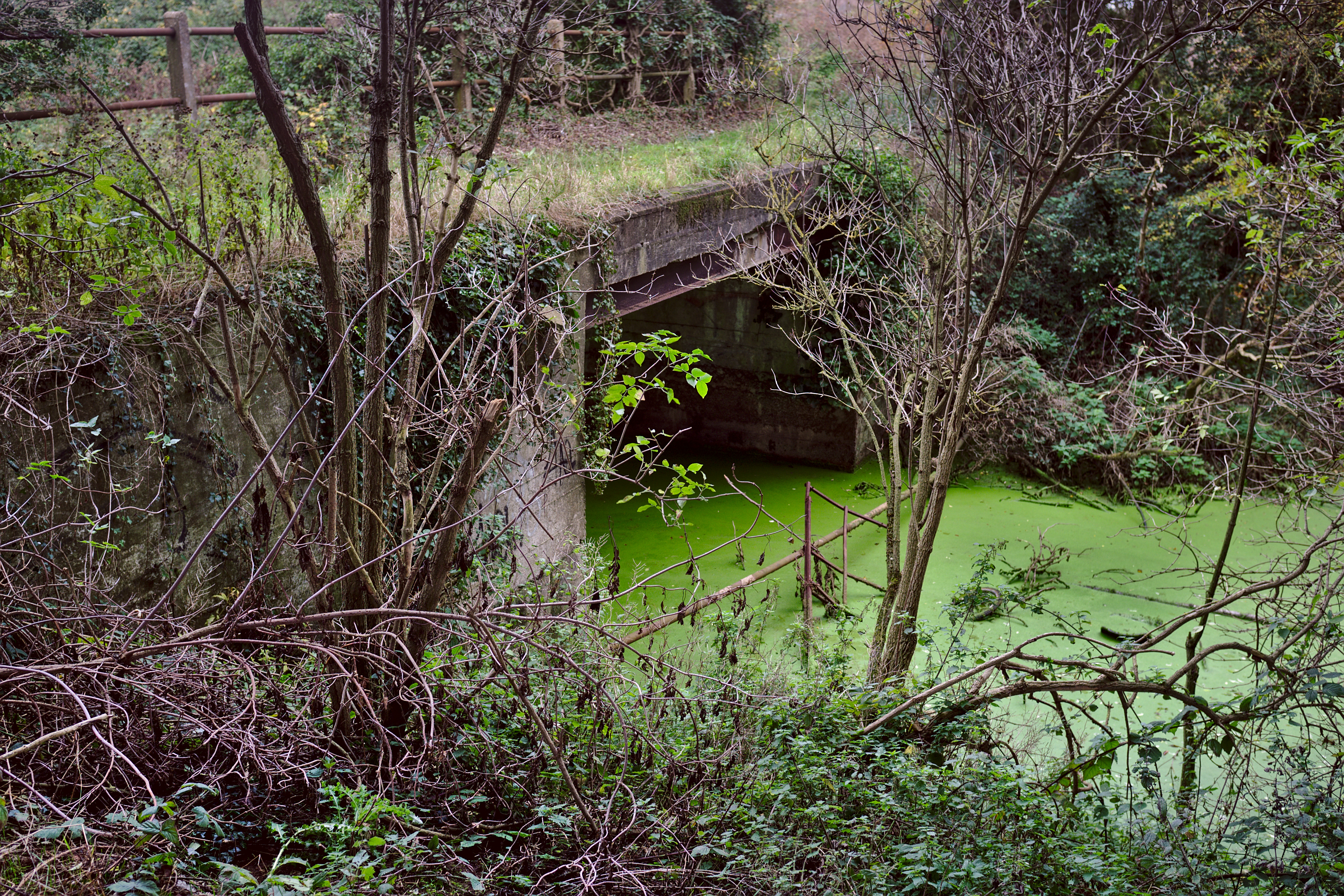
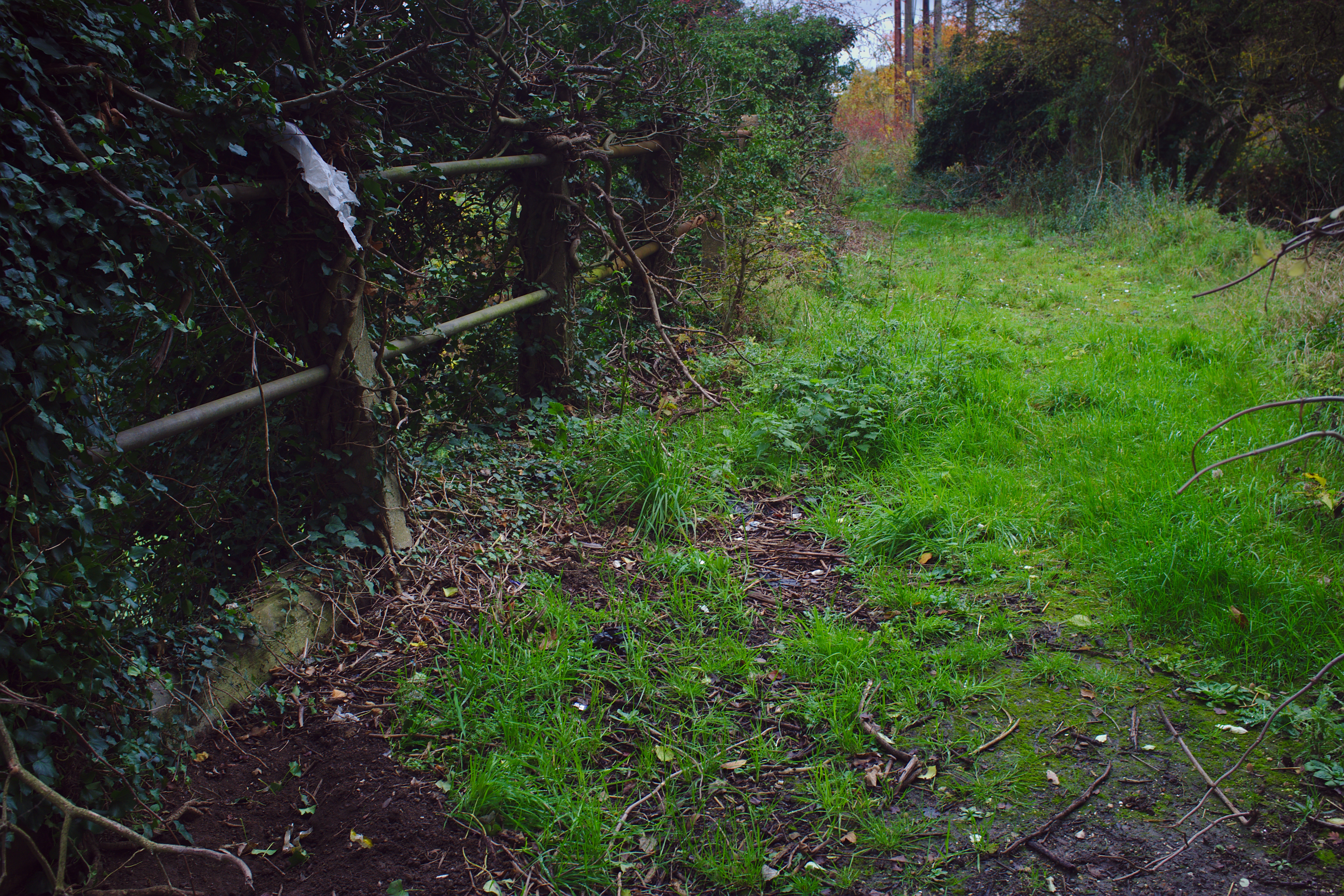
Very close to Harbour Junction, in the shadow of the A47 bypass, is this very small concrete-and-steel bridge in not such a great state of repair.
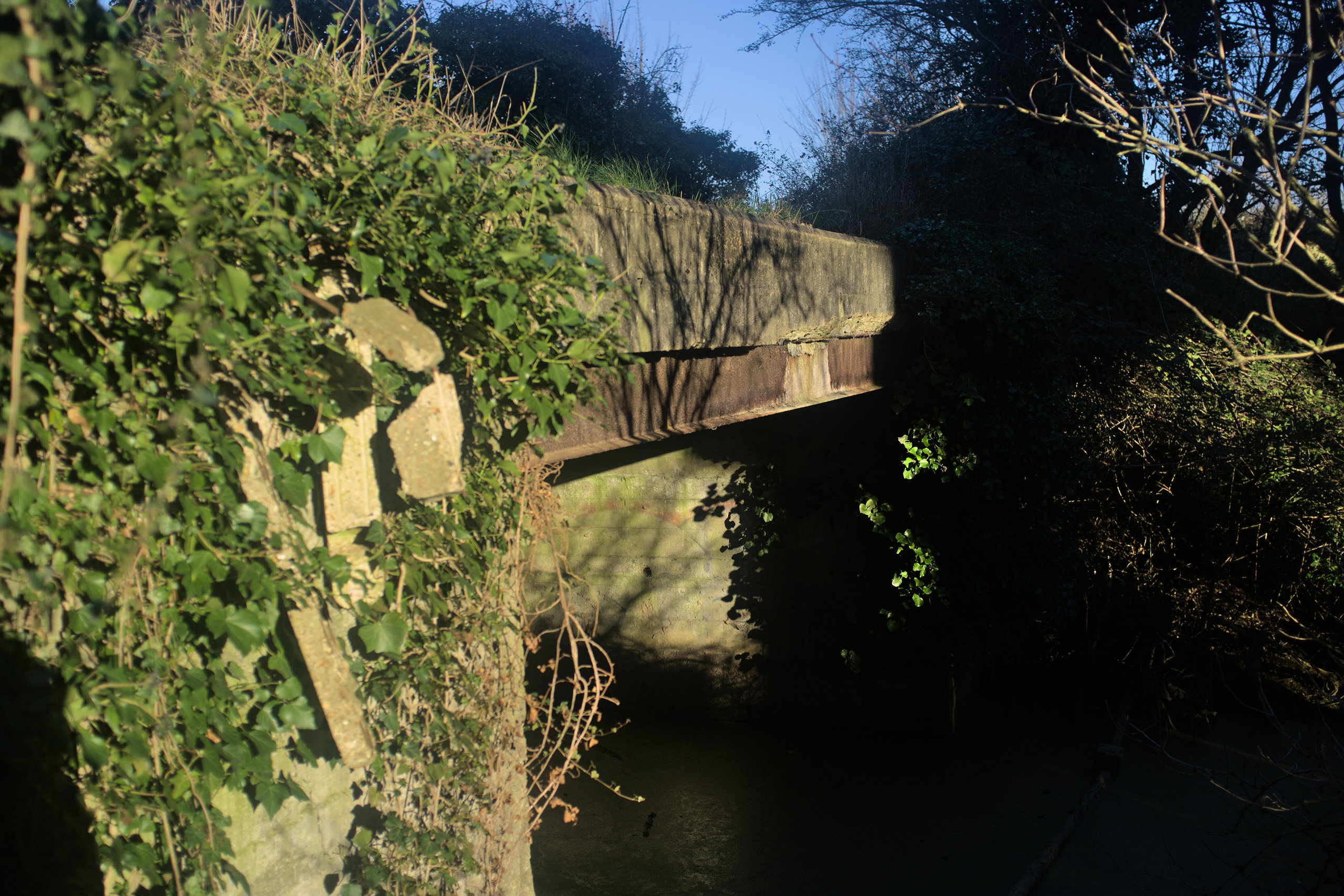
This is not a railway bridge, as in a bridge which would have railway tracks going over it. Its proximity to Harbour Junction and its rather beefy-looking railings have caused people to assume that it is; old maps and the bridge’s construction say otherwise. But we can see some kind of railway-related purpose for it.
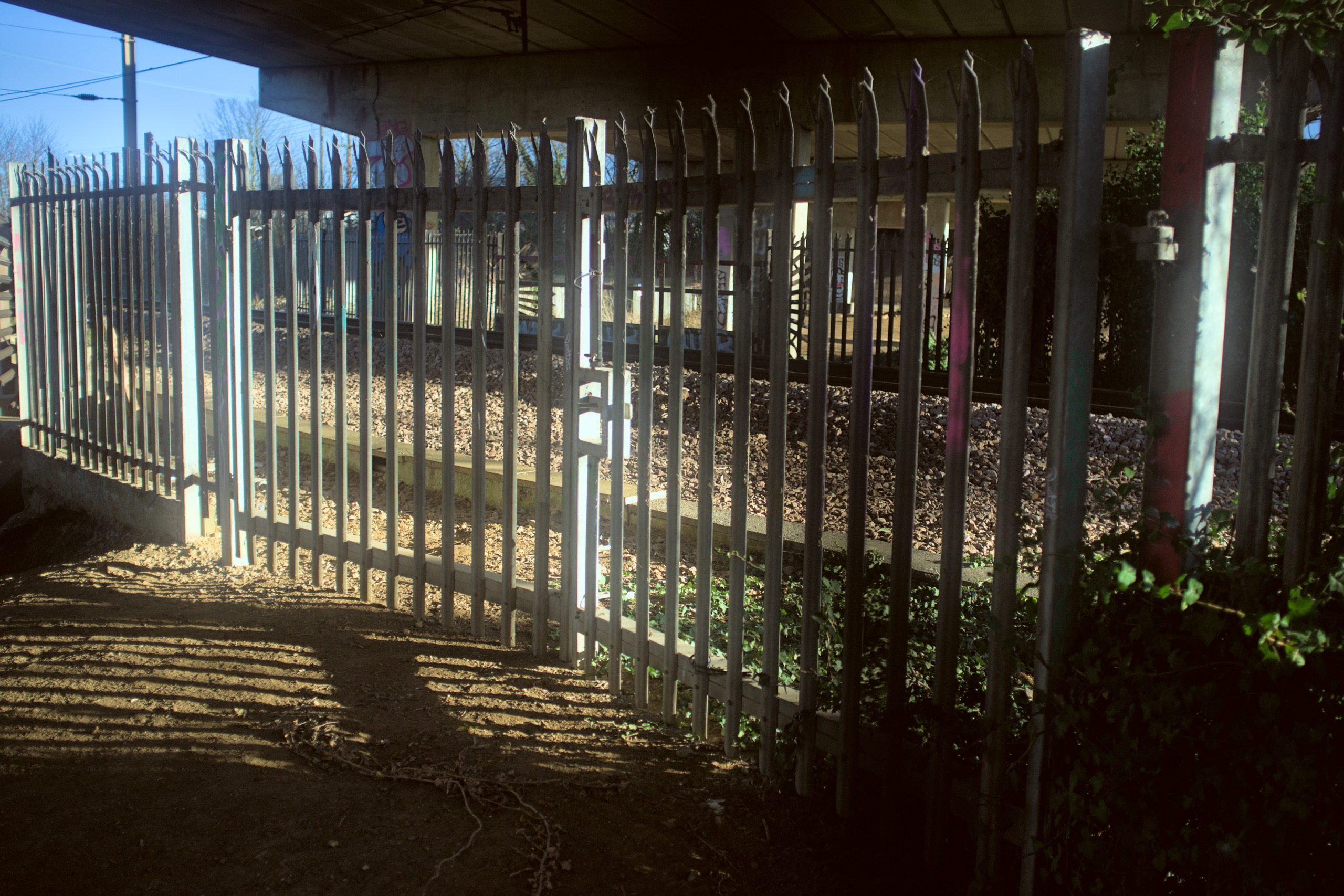
For many years there was an “occupation crossing” over Harbour Junction. These are crossings, usually user-operated, which are built for land owners whose land is cut in half by a railway. There are many of these on the Fen Line, though Network Rail would apparently rather like to close them (because of all the accidents that happen at user-worked crossings).
That would have been more or less where this gate is today.
You can see both the crossing (outlined in green) and this bridge (outlined in red) in the old map below (courtesy as always of the National Library of Scotland).
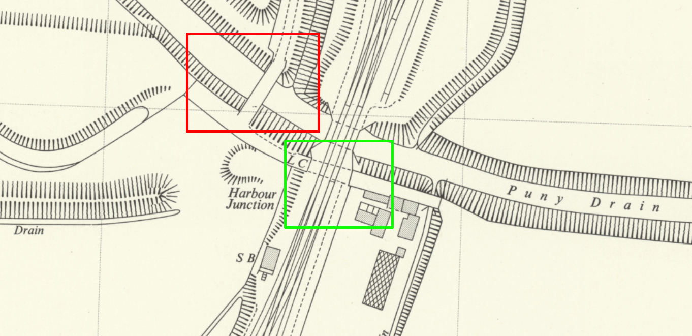
The bridge carried a track (probably a farm track) that led to Horsley’s Chase, which eventually met Hardwick Road some distance away. This track crossed Harbour Junction into some buildings a few metres on the other side of the railway. So that makes it at least partly railway related.
For another railway connection, I think (but do not know) that this would have provided access to Harbour Junction signal box for the signalman. The Norfolk’s Disused Railways site has a photograph of a motorbike parked next to the signal box; I don’t see any way that could have made it to the signal box without crossing this bridge.
And that is why we can say this bridge had something of a railway-related purpose. Even if it didn’t, it’s worth having here just so it is not confused with what it is not: a bridge which once carried a railway. It isn’t!
The railings have fallen into the water, as you can see in the picture at the top, so try not to lean too far that way if you visit it. The deck is still safe to walk on, and despite being unused for decades has only succumbed to overgrowth where the remaining railings are merging with the foliage at one end.
Very nearby - a five second walk - is BGK/1778. It’s a nice construction of engineering brick with horizontal concrete reinforcements dating from 1958 (though the abutments look older). That doesn’t really merit its own page on this site, but it’s here because I like it. The sign on it is a reminder that every tiny bridge over every tiny drain is something that is catalogued, inspected and maintained; infrastructure is kind of a miracle if you think about it.
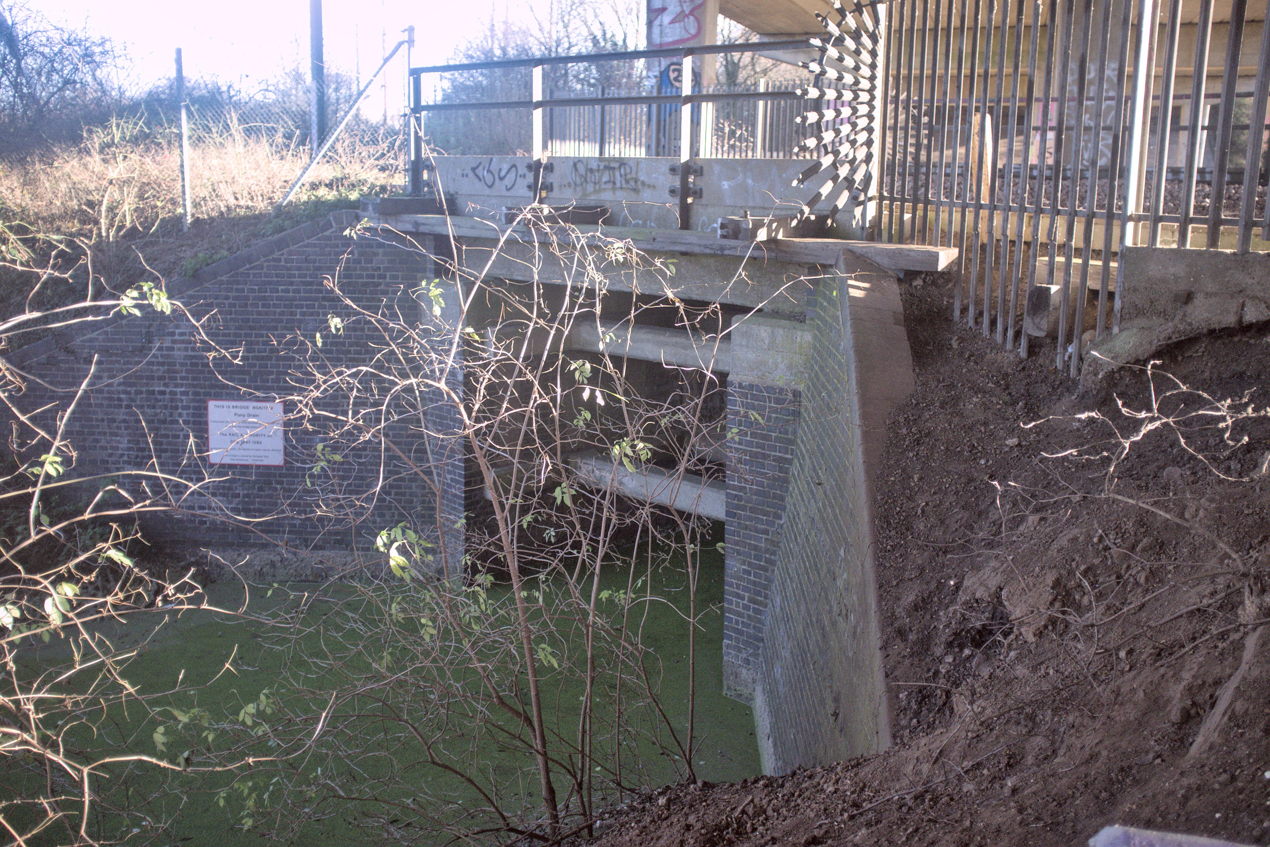
It’s a good place to reflect; it’s rather peaceful down there, once you tune out the rumbling of the A47.