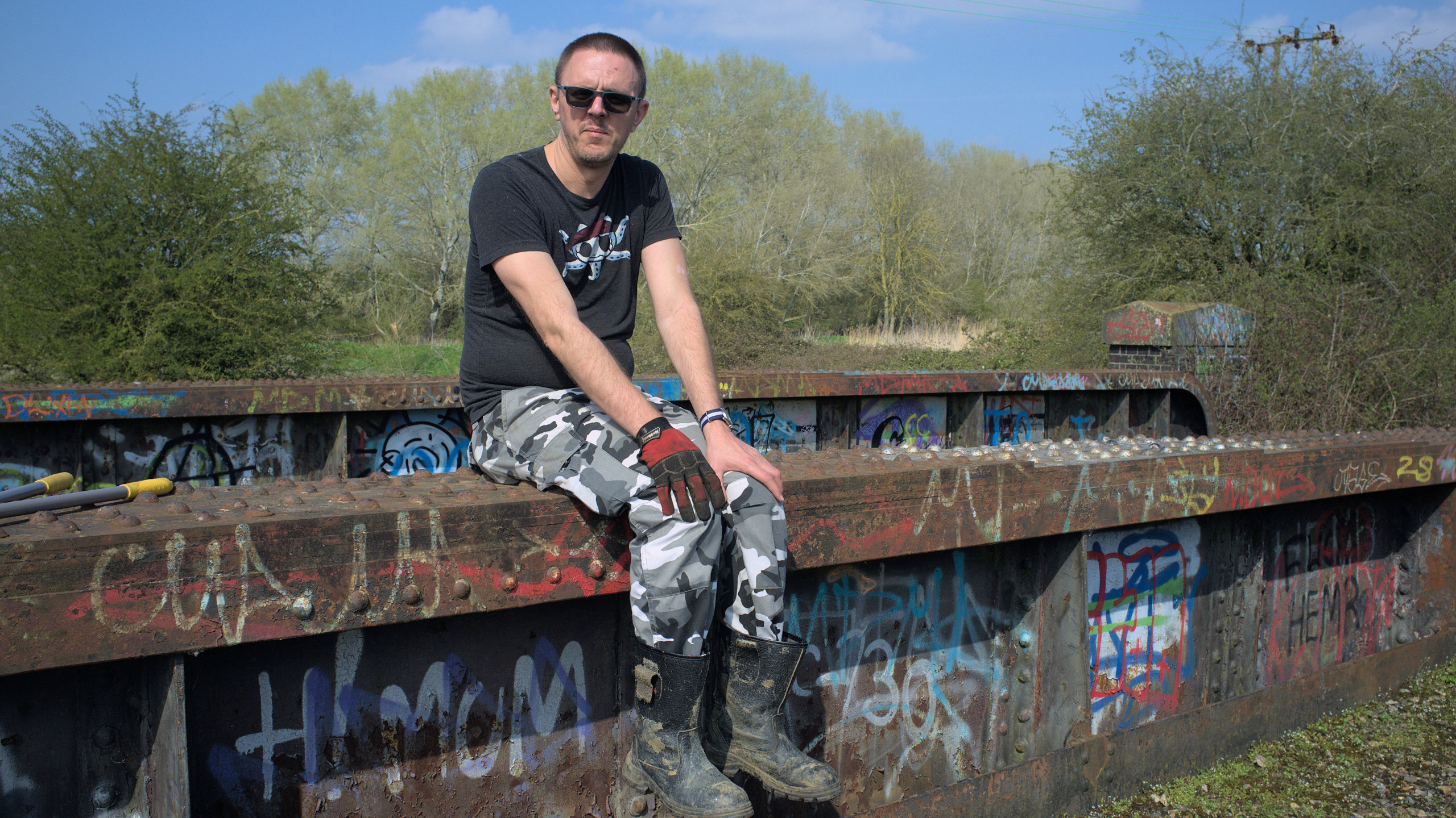
There are two bridges over the River Nar just south of the A47 bridge over the same. Here’s a younger, somewhat thinner me sitting on one of them some time in 2007.
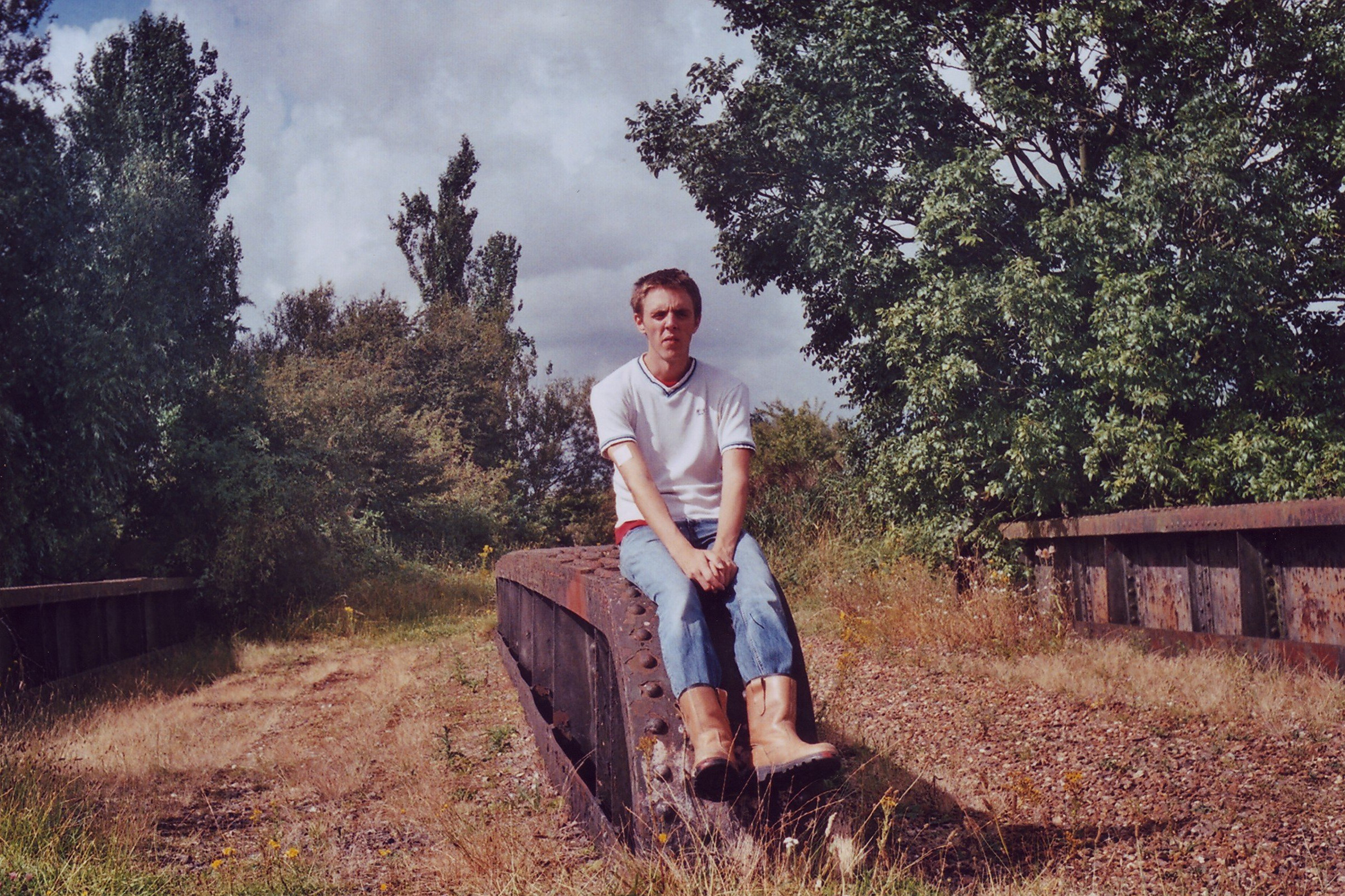
As I’ve said elsewhere, I’ve been doing this a while.
(Actually, that photo resulted in the only time I have ever been recognised in public by someone I don’t know. I was on the Mid-Norfolk Railway and asked a conductor a question about the DMU we were sitting on, and after answering the question asked me if I was the fellow who had that little web page about South Lynn. I digress, and I love to digress.)
These bridges used to be a little difficult to get to, and I used to need a little map to tell people how to get to it. With the recent pedestrianisation improvements in the area in the little while since, these days you can just jump onto the footpath on the east bank of the river anywhere north of the Nar Ouse Way (near the King’s Lynn Innovation Centre is a good bet), head south on the footpath, and keep going about 200 metres after the A47 bridge.
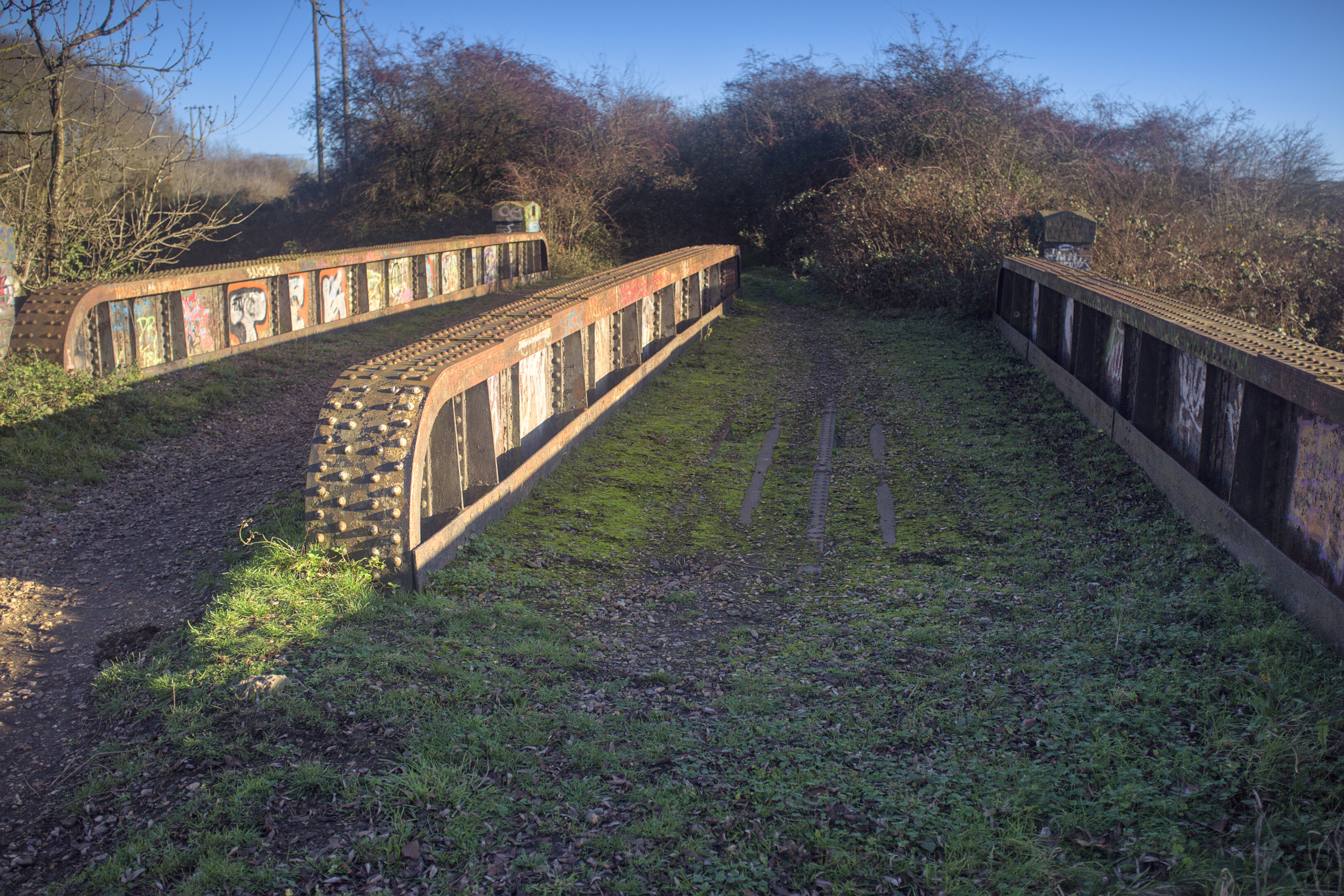
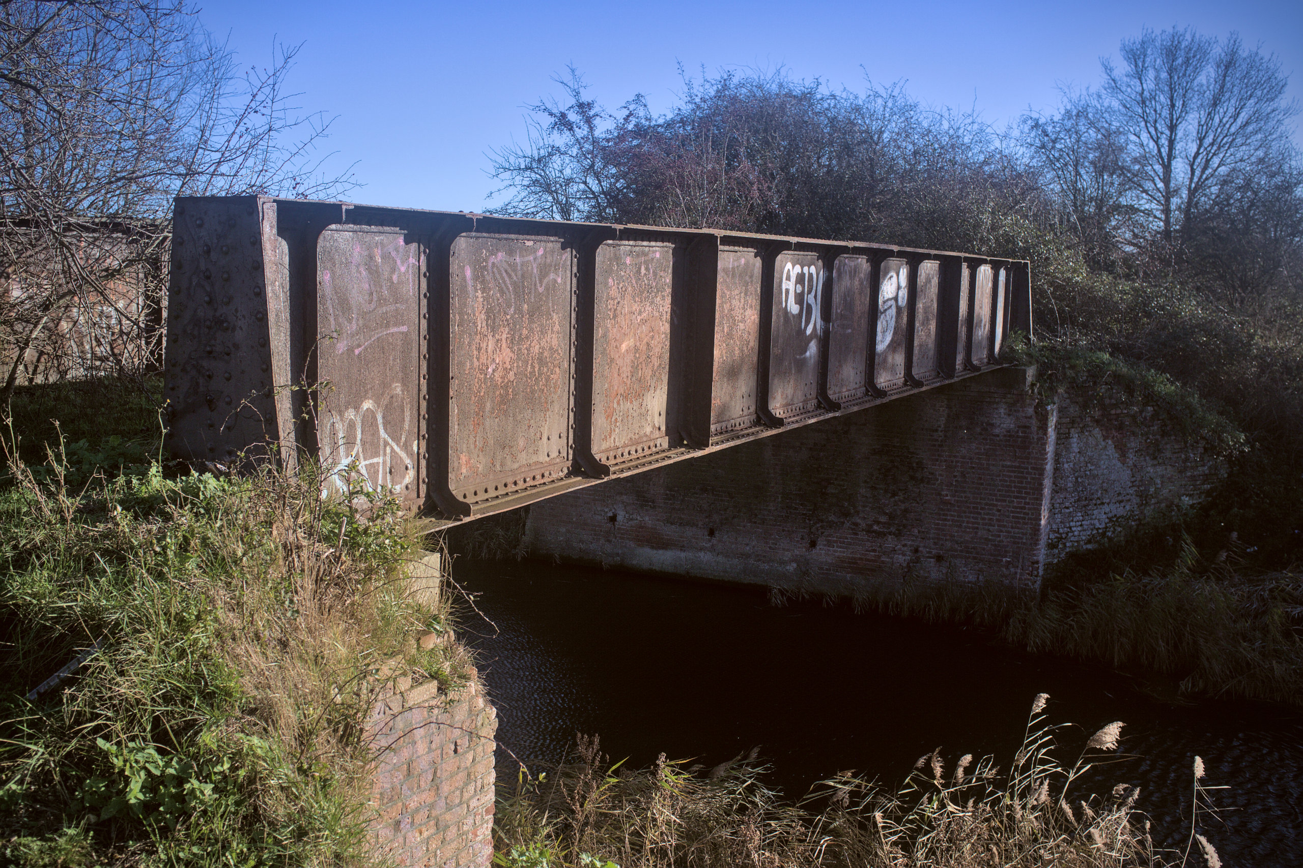
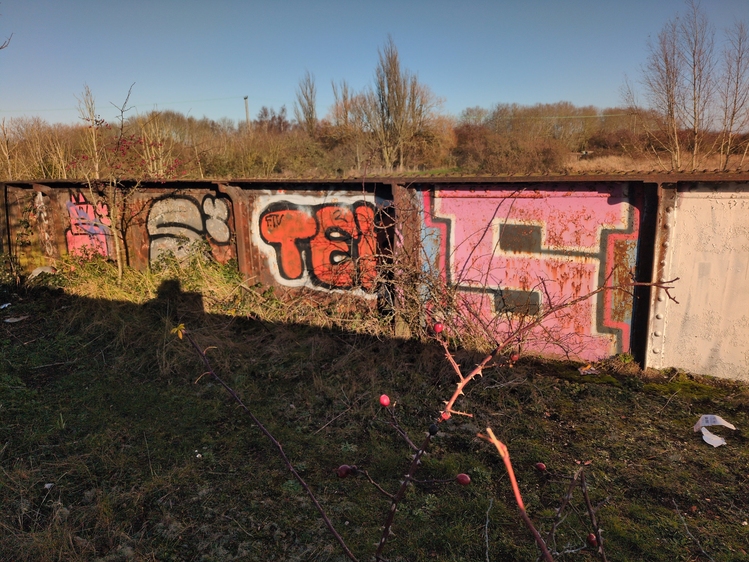
The first one you will come to is the one pictured above, with me. It is M&GN bridge 51, which under the British Rail system became SOL/51 (SOL referring to the South Lynn branch, which is the short spur of track from Harbour Junction to the junction with the Midland & Great North Joint Railway at about the south eastern edge of the traveller’s site today). Here it is in 2025.
This bridge used to carry trains from King’s Lynn station to South Lynn station onwards until 1959, and freight from King’s Lynn yard (now the site of a Morrisons and a Matalan) to the beet factory until the final closure of that last remnant of the South Lynn branch in 1994.
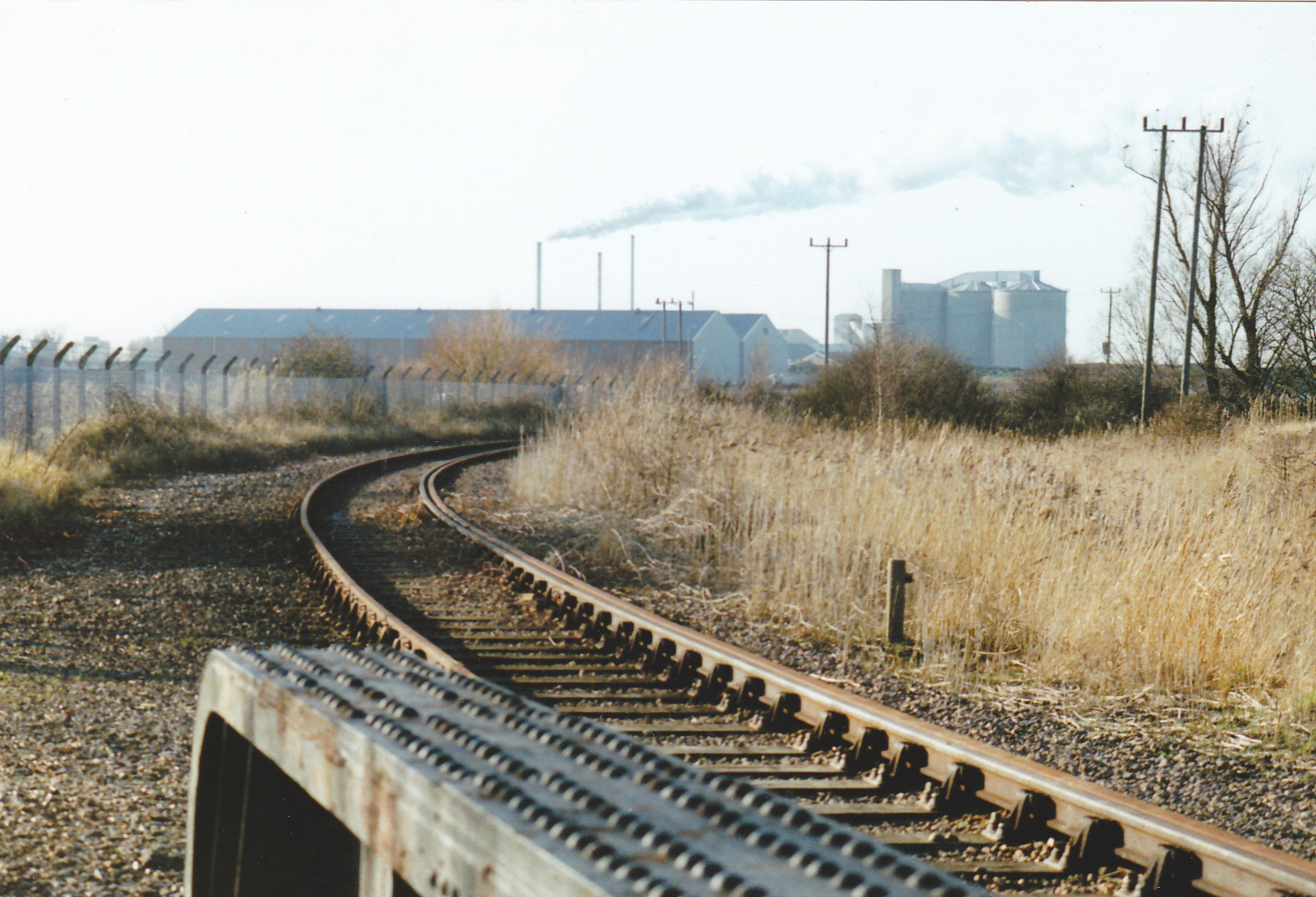
In the M&GN days, both sides of the bridge were used. After the closure of South Lynn and the entire M&GN network in 1959 the right side of the bridge (in the photo above, which is looking north-east-ish towards Harbour Junction) was used for the single track that ran to South Lynn’s yard. Some time after that (probably around the time of the remodelling of Harbour Junction and the closure of the signal box there), the track was moved to the left hand side. You can see that in the photo below by Nick Youngman, facing in the other direction (and also shows the beet factory it served in the distance).
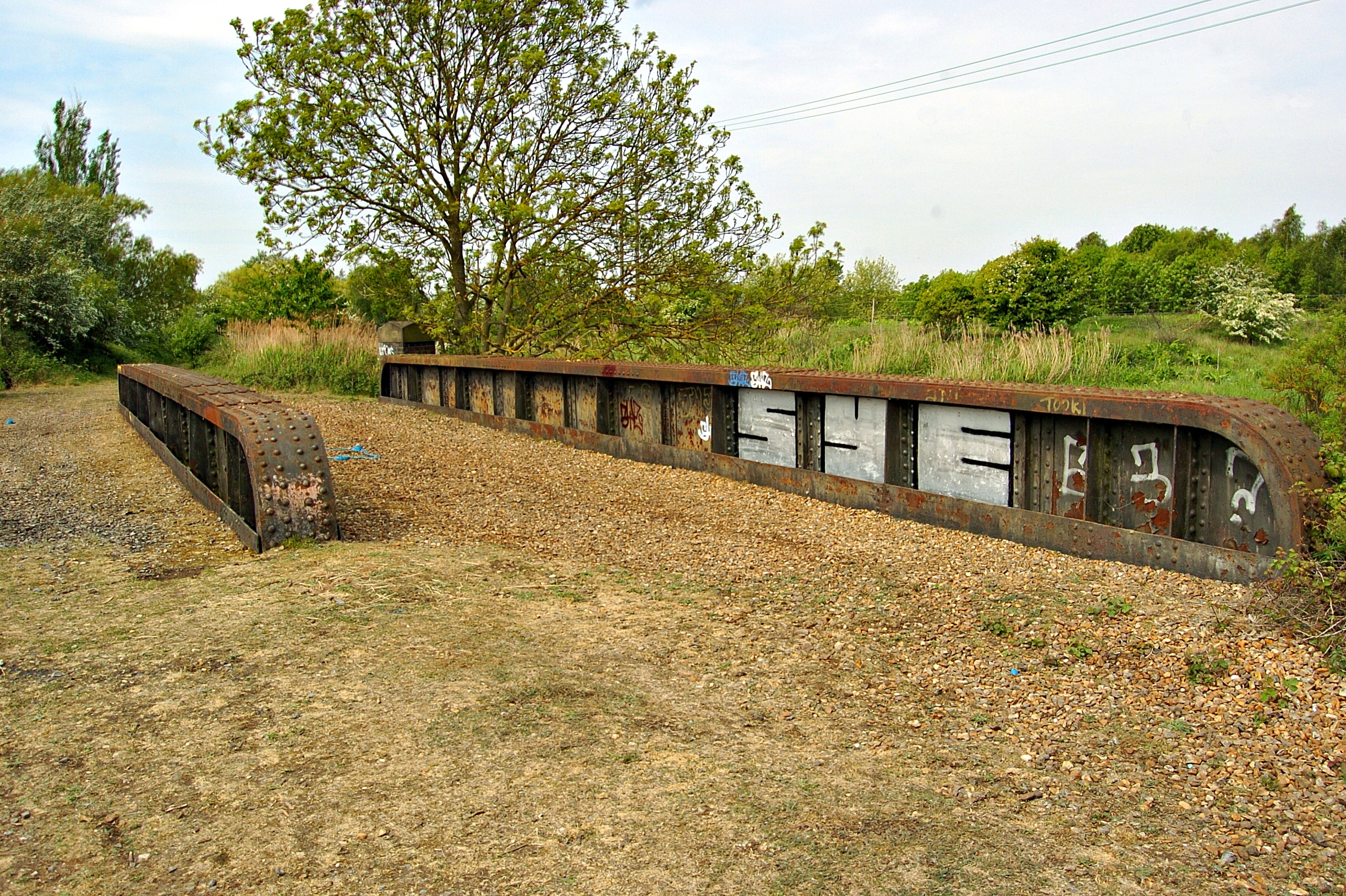
Every time I visit it I am struck by what wonderful condition the bridge is in; the only thing that hints at decay is one of the cosmetic walls having collapsed, and the predictable graffiti.
I don’t mind the graffiti, understanding it (as I have said elsewhere) as just another part of the life of a disused structure. And if it had not been for this “SYE” graffiti which was still visible in this 2011 shot…
…then it might not have caught my eye on a journey into King’s Lynn on the train one time, and it is likely none of these web pages would have happened.
I love the details of this bridge; even the most tiny, insignificant bridge over the smallest river constructed in this era seems massively overengineered. Of course, that could be survivorship bias; the alleged dubious safety of a bridge across the Ouse a little west was cited as a factor for closing the entire M&GN system.1 But this one is nice!
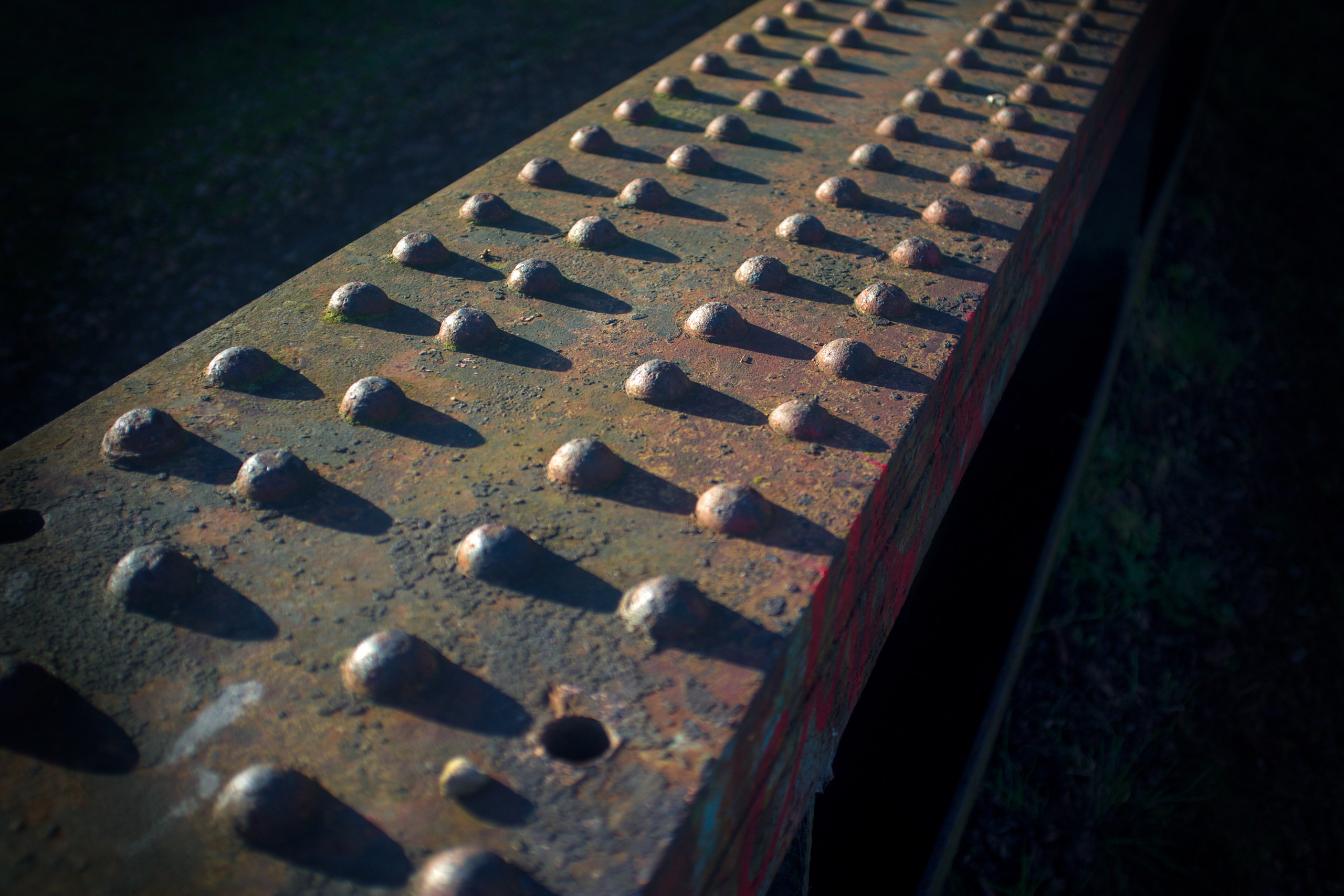
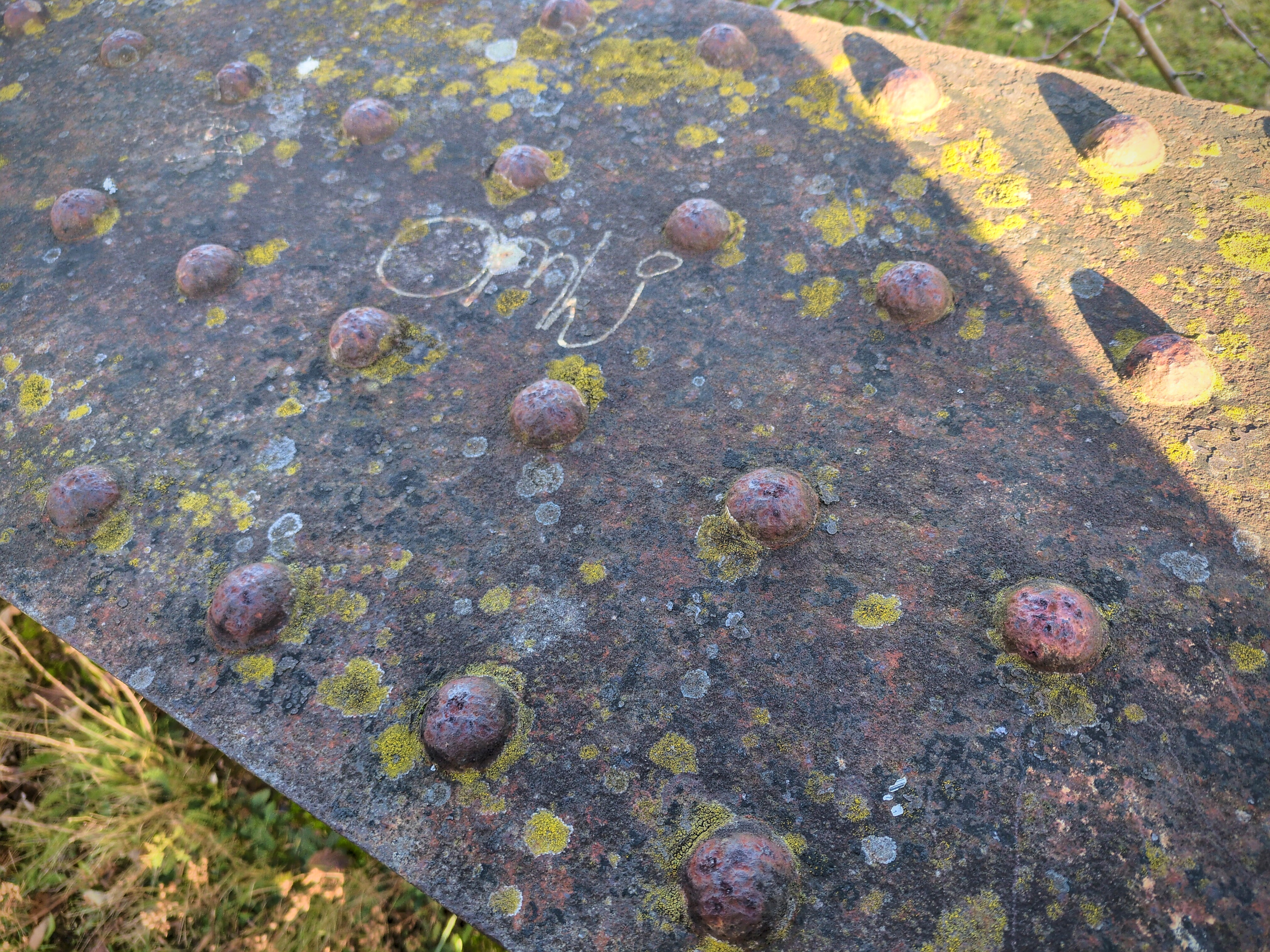
Hot rivets are always my favourite detail of these, reflecting the manual labour that went into them. I suppose the equivalent in the year 2175 will be looking at some nice TIG welds – and maybe that’ll be robots marvelling to each other how we did that with our silly, fleshy hands.
As said, most of the bridge is in beautiful, strong condition. The brickwork on the return walls is falling apart. Here’s one of the return walls on the west bank:
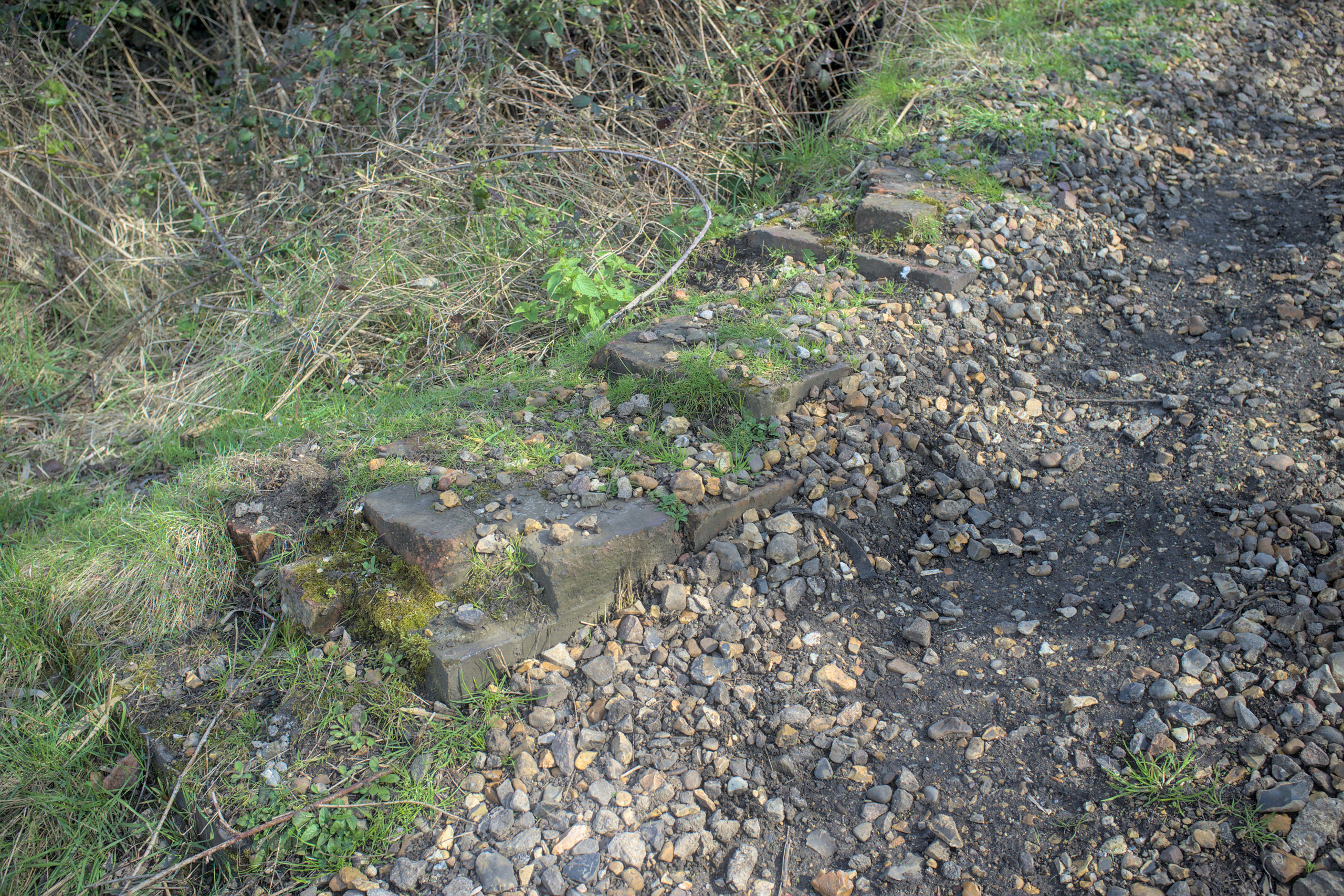
And here are some nice engineering bricks with an even nicer stone cap at the end of one of the surviving return walls:
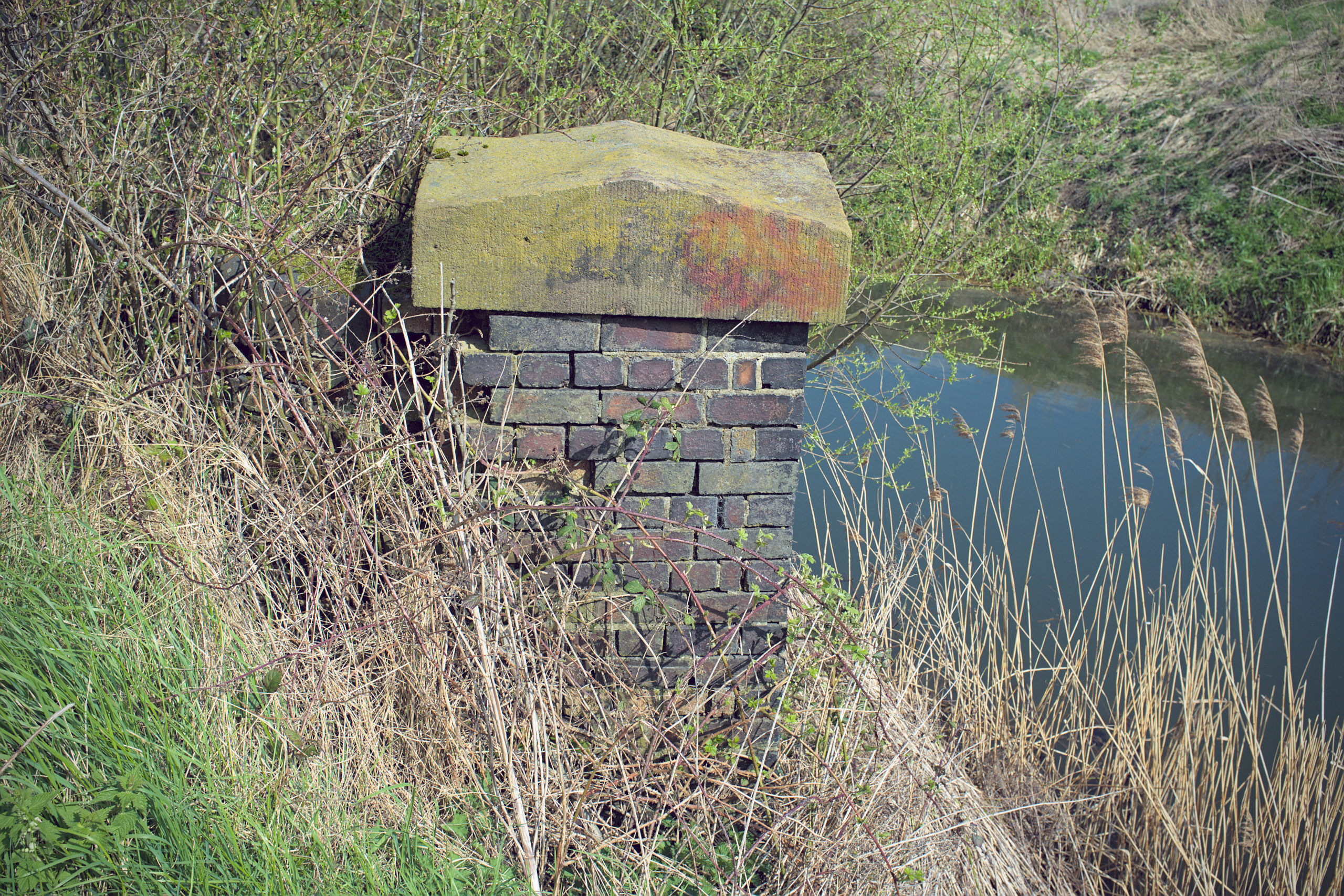
All four of the substantial parapet posts still exist. Here’s one of them.
As a curiosity, this same parapet post (before it was painted over) used to carry a designation of PMY2/53:
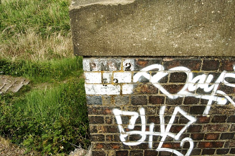
This led me to believe for a while that this bridge is PMY2/53, because it’s written right there! But this is wrong, and someone made a mistake painting this on this bridge; as said earlier, under the BR system of structure designations this is SOL/51. PMY2/53 is actually a bit further south on the Nar, and we will talk about it in just a moment.
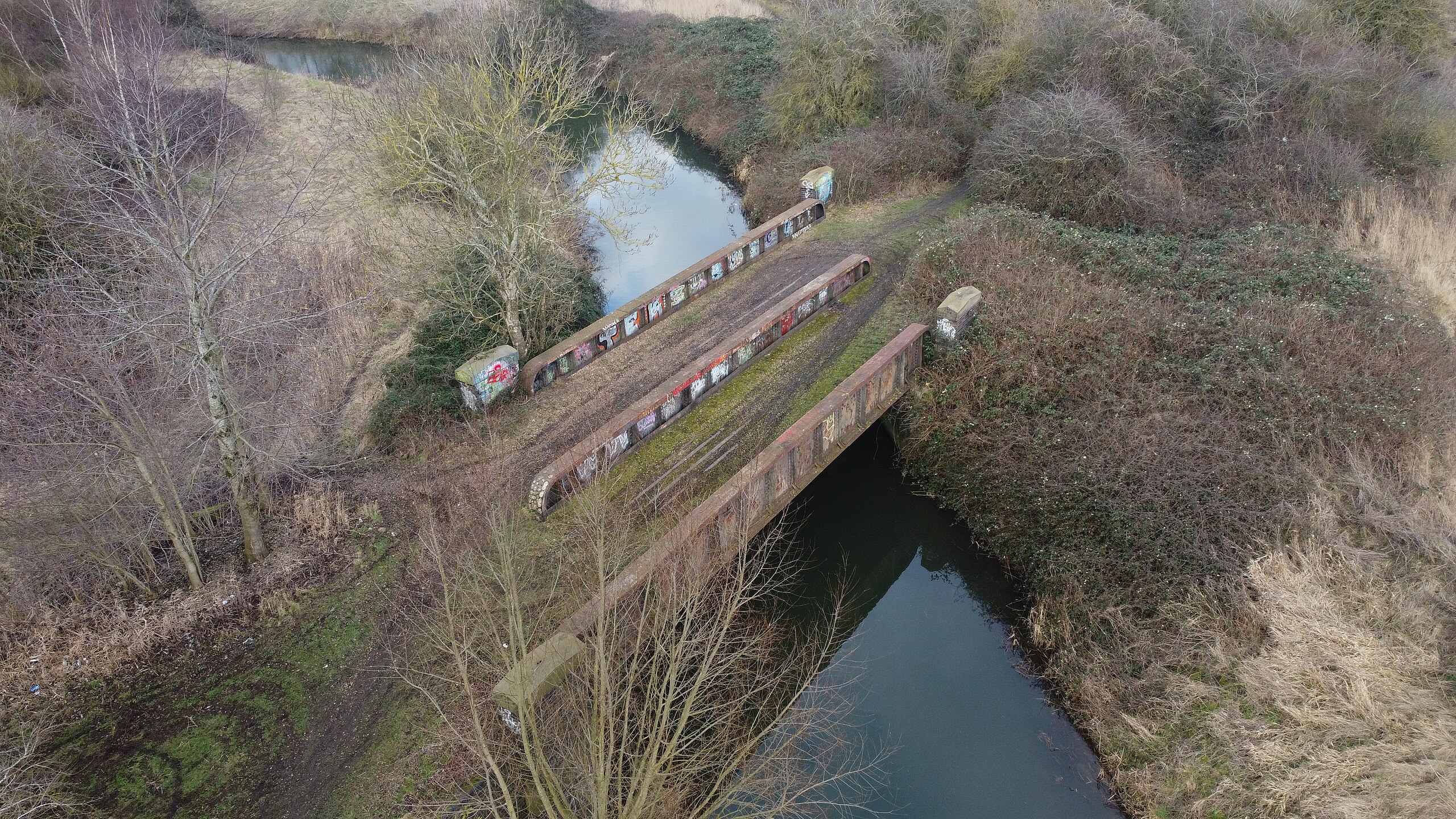
Today, this bridge is mostly used as a footpath to get from the east bank of the Nar to the west to continue walking south; the east bank upstream of this bridge is rather unwalkable without a brush cutter, and perhaps a chainsaw. You can see this rather well in this aerial photo from Norfolk’s Disused Railways, which also gives an excellent alternative perspective to the usual ones at ground level.
One last look back at the bridge from an earlier time.
I took that in 2008; it was before the vegetation had taken over quite so much, and gives a much better view of the brick abutments than you can see today.
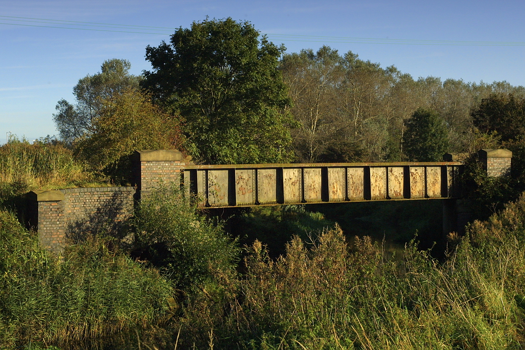
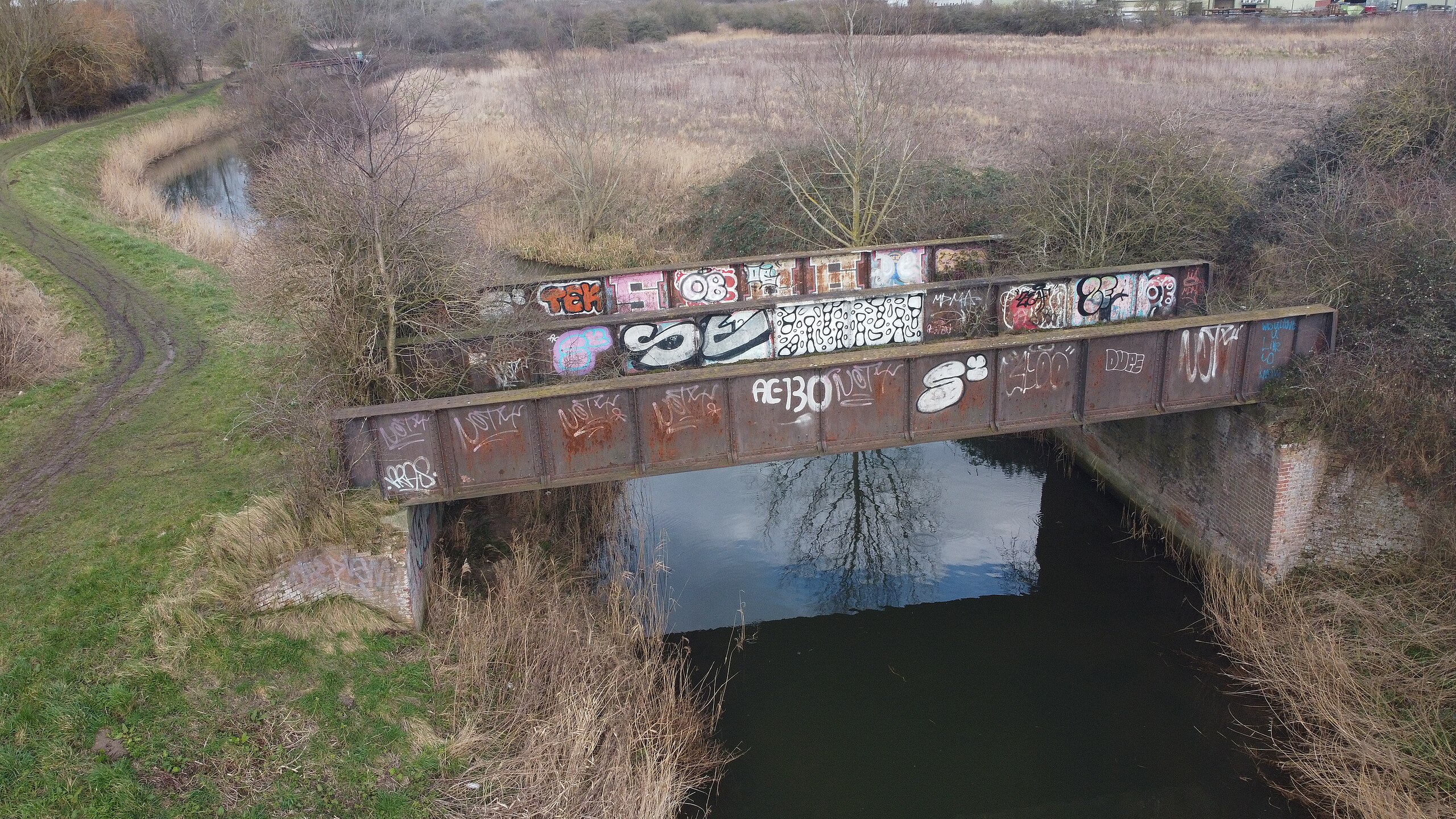
Let’s move about 130 metres upstream to the next bridge over the River Nar; smaller, but still beautiful. This one is the real PMY2/53, or M&GN bridge number 53.
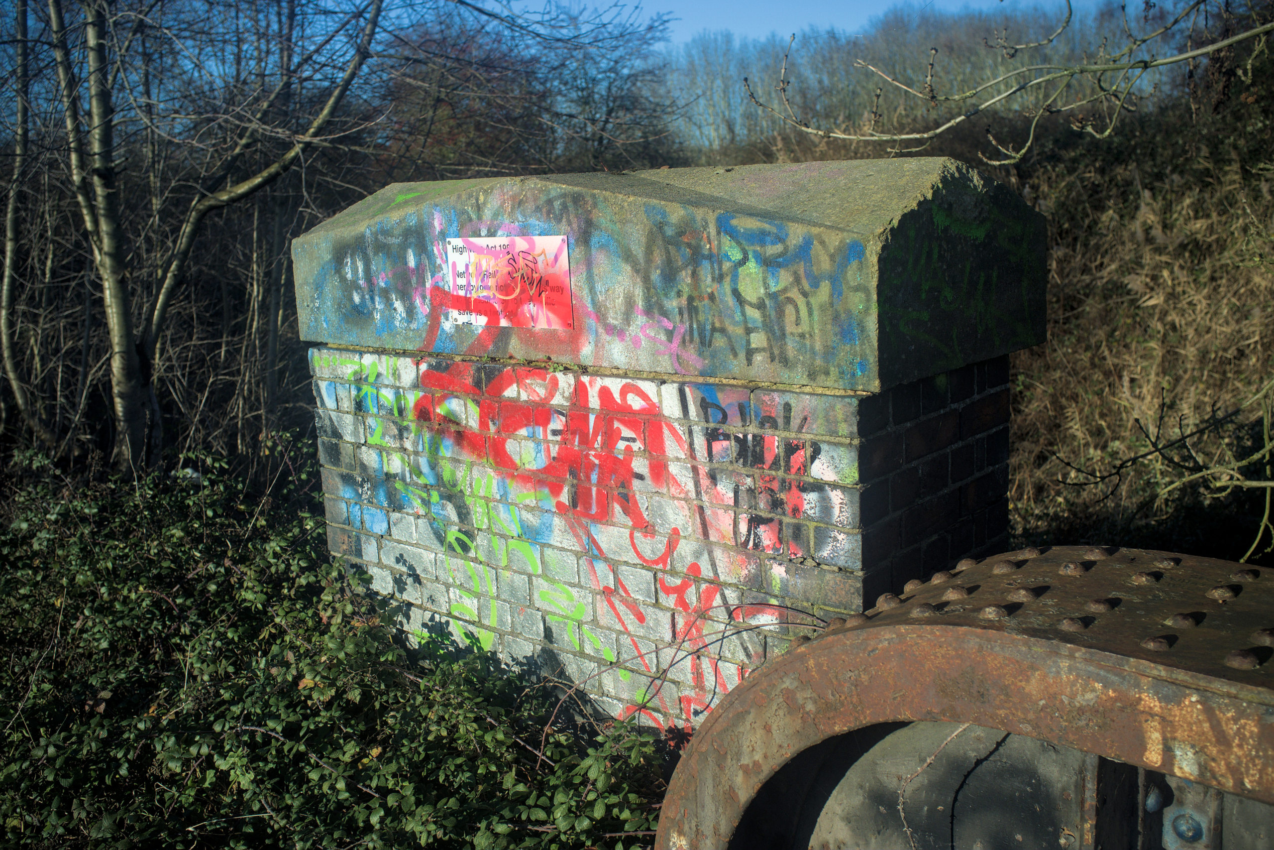
PMY2 here is the designation for all structures from the junction of SOL (see above), over the Fen Line then out to Melton Constable and Yarmouth. Most of PMY2 was closed after 1959, with freight continuing along this bridge (on a single line running over the southern side of the bridge) to East Rudham until 1968. PMY1 would be from that junction to South Lynn station and onwards to Peterborough. That’s why you’ve got a DfT marker painted on it, which somehow has not been graffitied over.
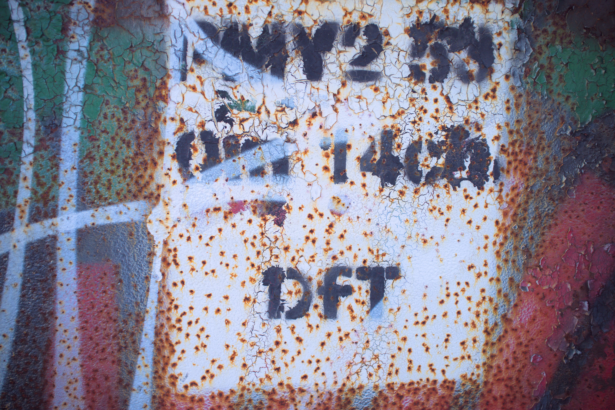
That tells you this bridge is 0 miles and 14 chains from the junction with the South Lynn branch (14 chains being a hair over 280 metres; a chain is 1/80 of a mile).
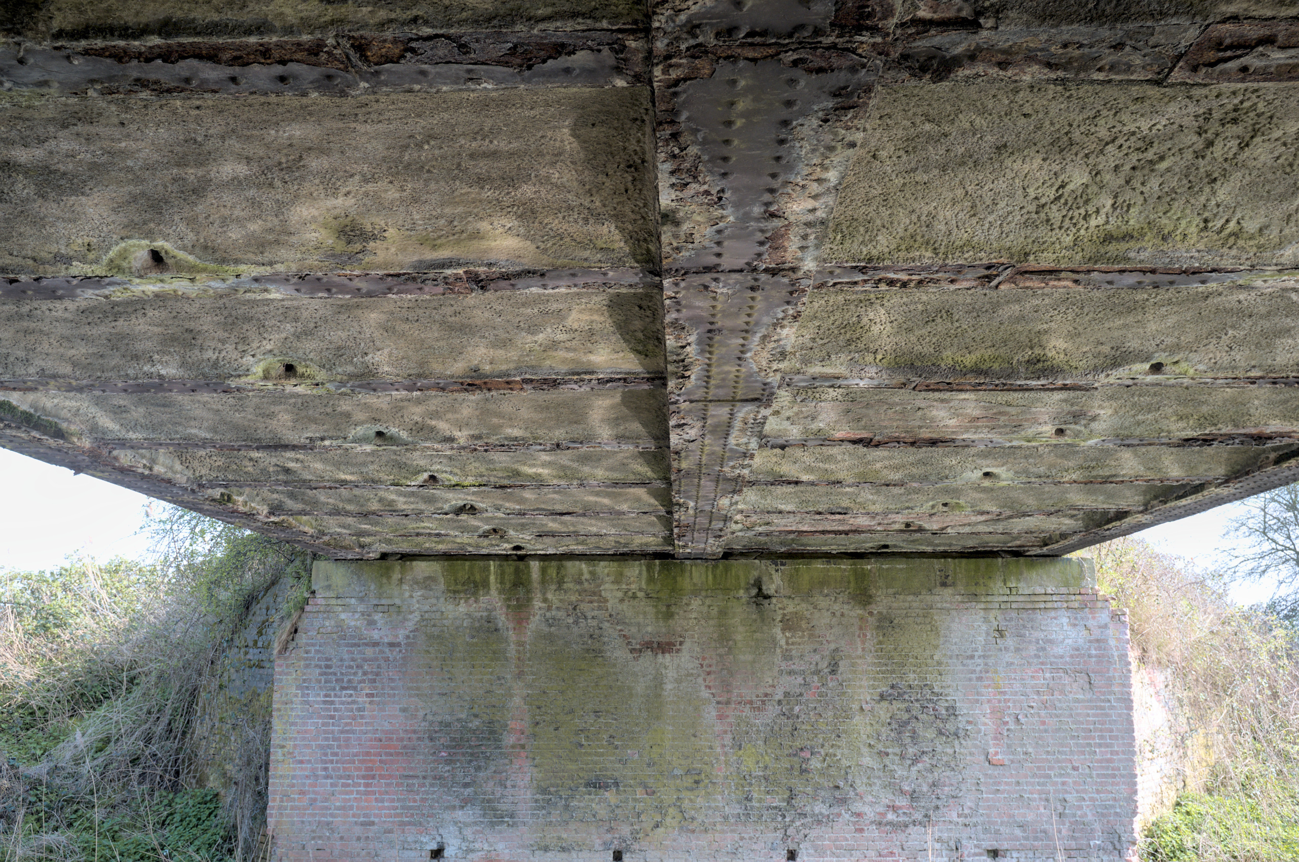
Unlike SOL/51, it is possible to get underneath the bridge. It’s quite peaceful watching the ripples in the water reflect and dance off the iron and concrete above.
The deck still exists, but is rather threatened by vegetation.
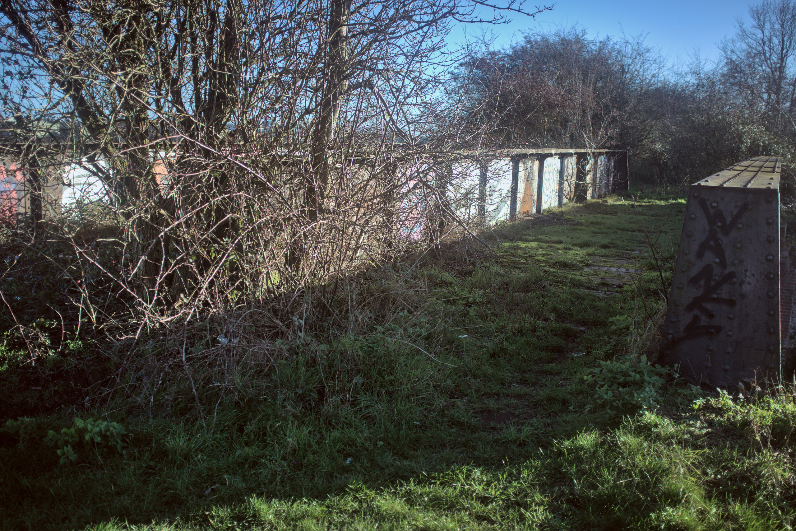
That’s because this bridge can’t be used to get anywhere; vegetation blocks off access to the east bank, which is nearly entirely taken over by vegetation itself. So the normal passage of pedestrians does not keep the vegetation down. The overgrowth is best seen, once again, from Norfolk’s Disused Railways’ drone.
But for now, the bridge continues to exist, and that’s more than I’ll be doing 140 years from now.
Finally, some detail of the bridge, and it’s my eternal favourite: more hot rivets.
Further reading
- The Lynn Avoiding Line and South Lynn on Norfolk’s Disused Railways, the best and most comprehensive site on this subject.
- The definitive list of engineer’s line references will always be useful if you find a bridge number and want to know more about the line that serves it.
-
But this is disputed by the late Ray Bullock in his book “A Footplate Man Looks Back”, in which he writes that one of the workmen demolishing the bridge told him that it only needed a good coat of paint (p. 115), and noting that “low loaders stacked high with lengths of track, which must have been very heavy indeed, were hauled over the bridge by two engines coupled together” – the bridge being strong enough to take a weight which was never allowed before closure. ↩︎