Travelling in to King’s Lynn on the Fen Line, about 500 metres before the A47 flyover (15-20 seconds at typical line speeds), the traveller who has tired of looking at their phone and watches the much better view out the window of the left side of the train will see this bridge abutment.
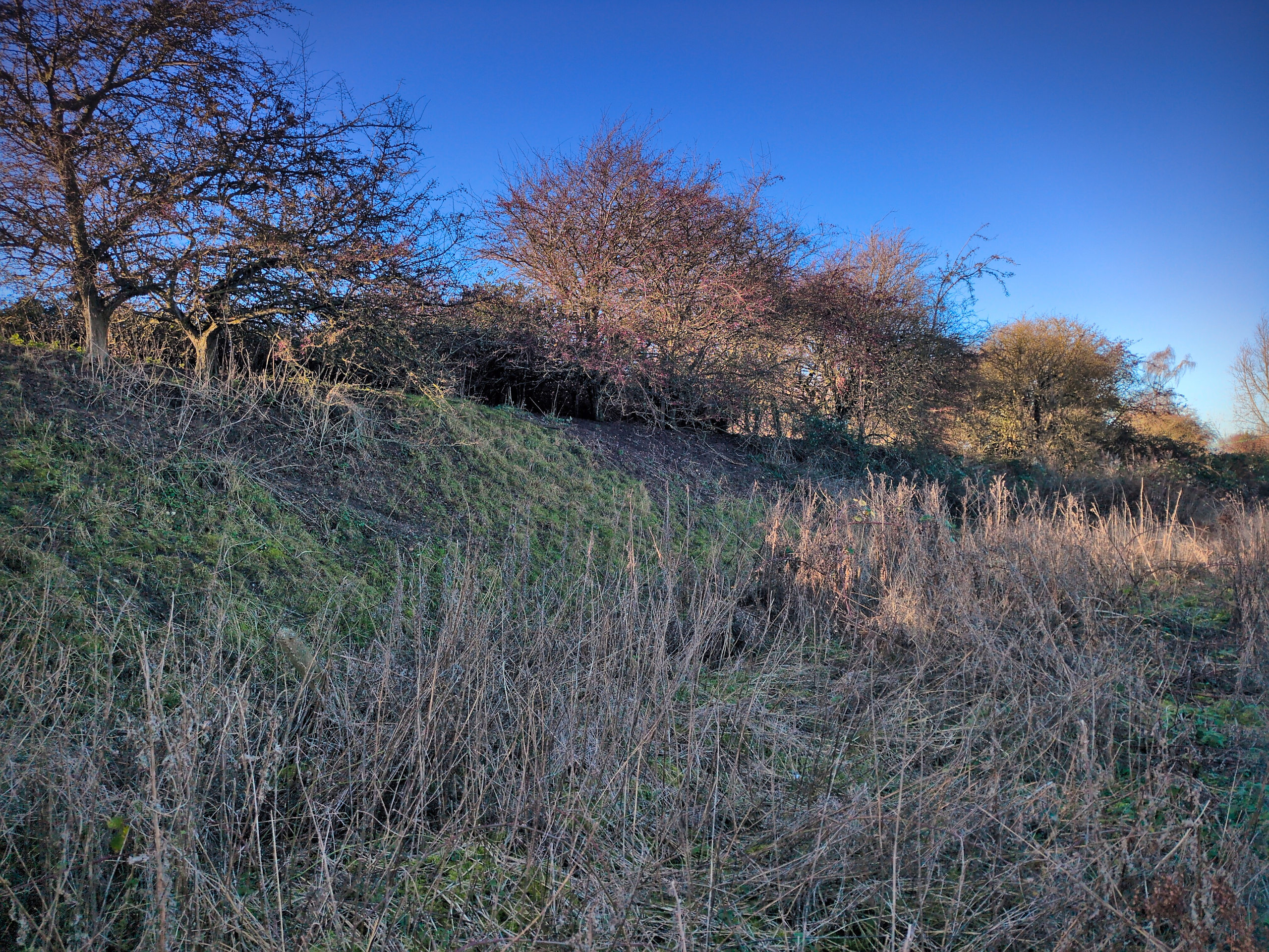
From a distance, though, and especially at the 70-odd miles per hour trains run through this section, the most obvious tell that there was a railway here is the stretch of embankment.
And you don’t even need this extremely-railway-like line of fence posts….
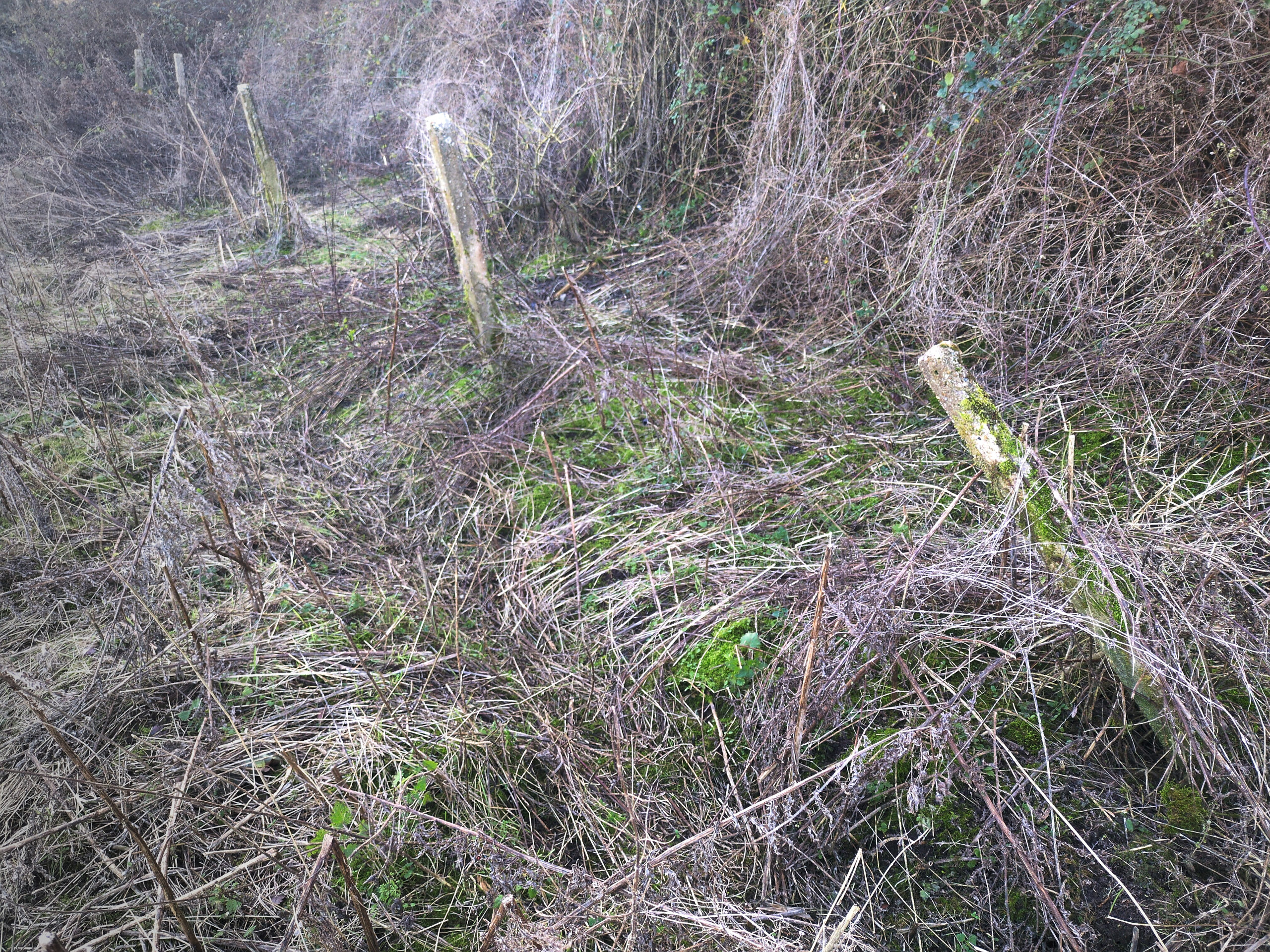
…to know that this is a railway embankment. If you come across a embankment in the middle of nowhere in England, it’s almost certainly a former railway and you might want to look it up!
So what was this bridge, and this embankment? It used to carry the Midland & Great Northern Joint Railway from South Lynn to Fakenham and onwards to Melton Constable, Norwich and other places towards the east. After the closure of the entire M&GN network in 1959 it was used to carry freight to East Rudham until 1968.
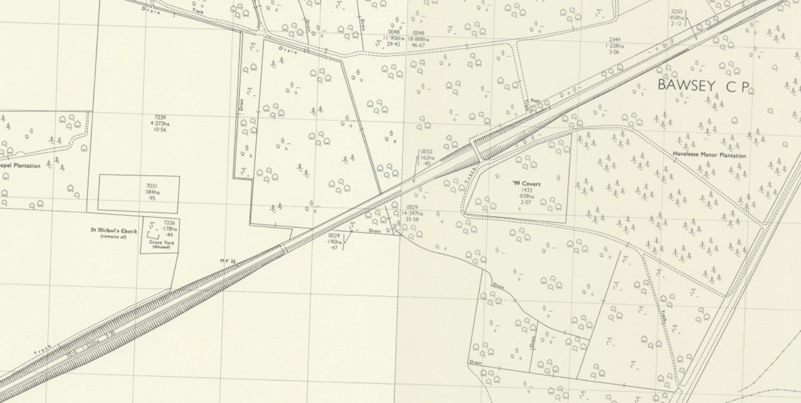
The map below shows that it was single-tracked during this brief post-M&GN era. (Other portions of the same map indicate that it was made after the M&GN bridge over the Ouse was dismantled; that clearly dates it from after the closure of the M&GN network.)
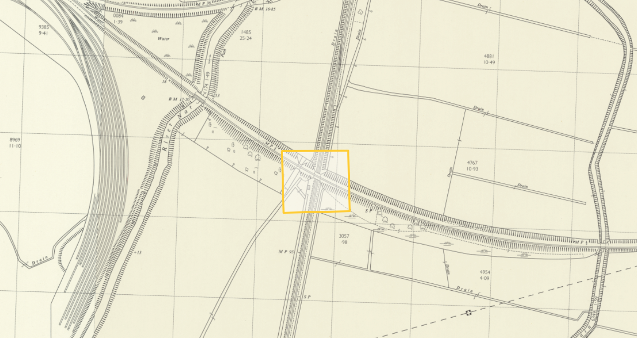
But the same map also shows that the line at that point in time (likely 1970) was dismantled after Bawsey Pits; alternatively, that the line continued that far for a while. I don’t know the significance of that for the history of the line, but it’s worth pointing out.
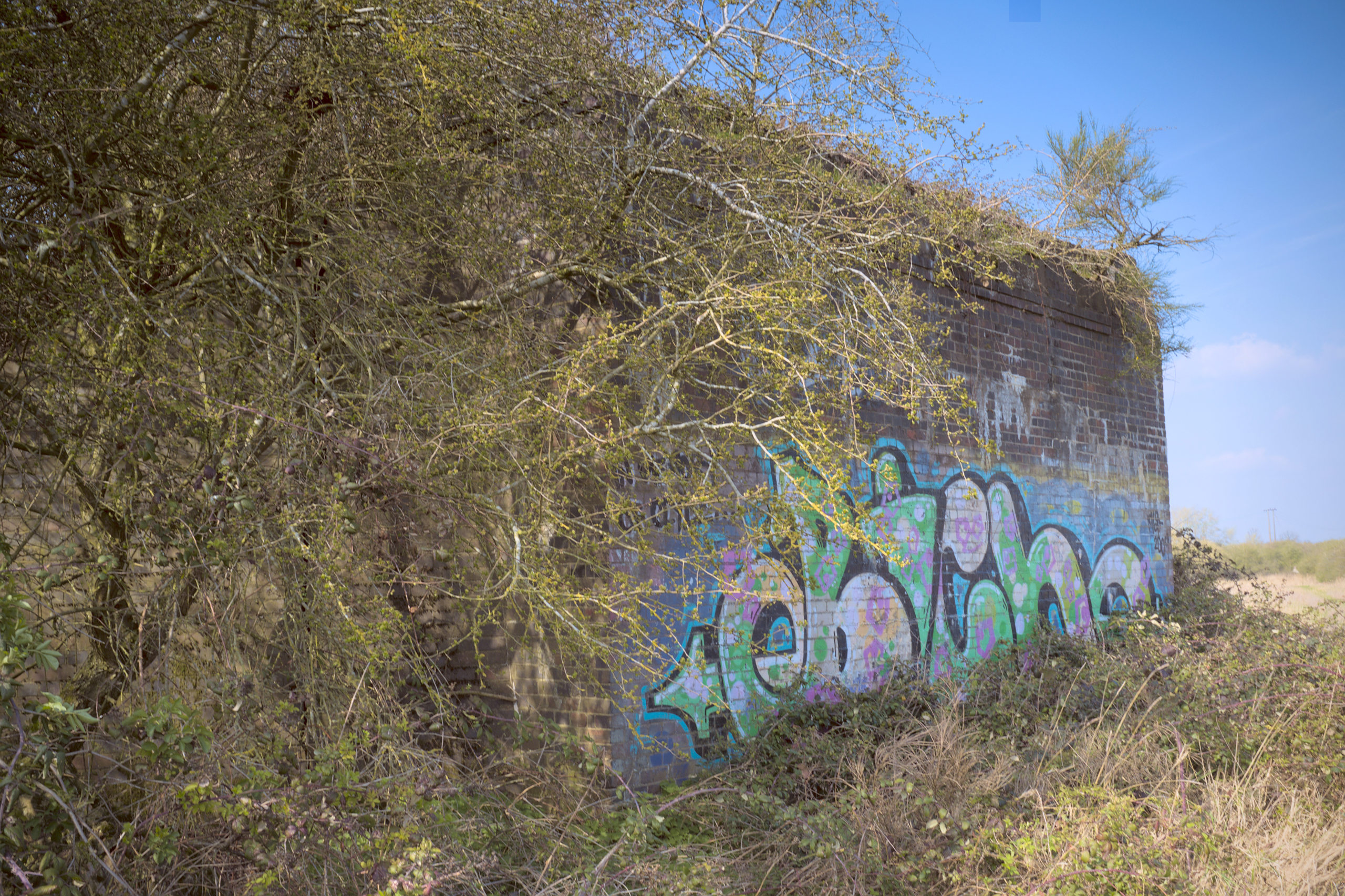
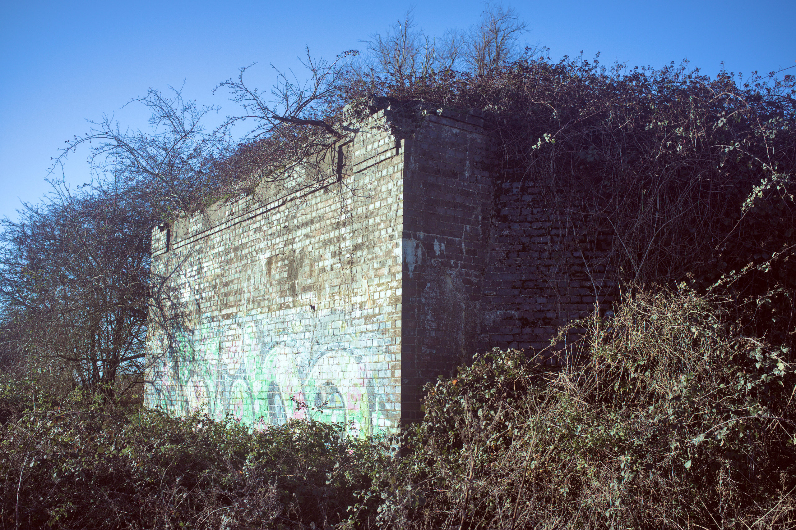
Anyway, let’s have a closer look at the bridge. Only this abutment survives; the other abutment and the deck were removed a long time ago. A look up at the top shows that this was clearly designed for a double-track line.
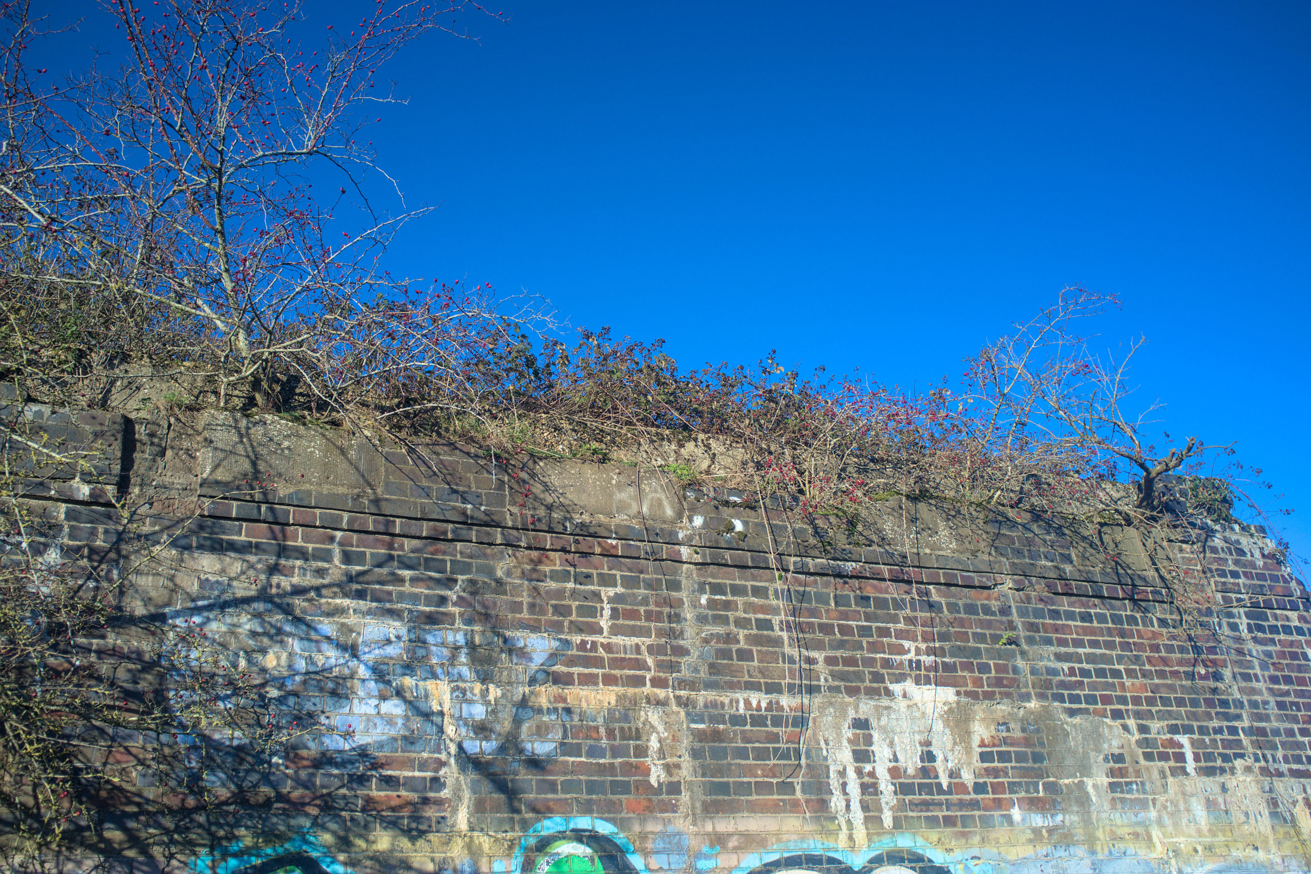
Back when I first visited this area the top of this abutment was a good place to relax and watch trains go by. The photo above looks like it might even be hospitable to that today. A look from another angle hints at how much the undergrowth makes that a less good idea to attempt today.
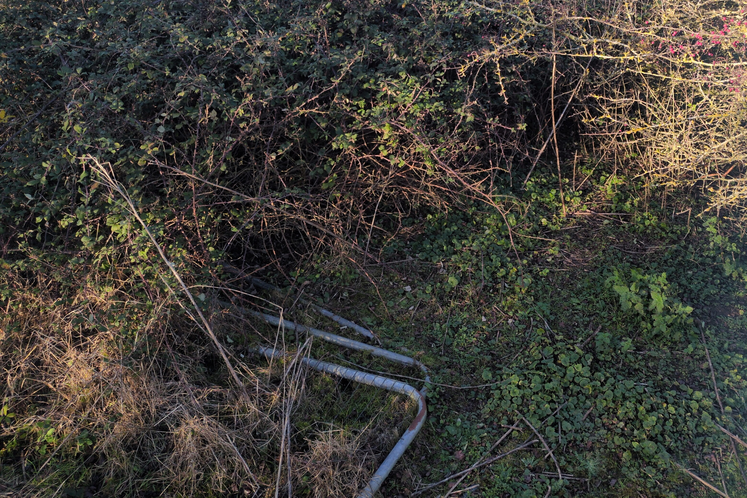
In fact it was possible back then to walk from PMY2/53 all the way to this bridge abutment. For a brief time there was security fencing on the embankment to stop anyone walking along it (and presumably not to discourage mere curiosity, but to prevent people who do not pay attention falling off the abutment). That’s still visible today, but the undergrowth has made it unnecessary, and is slowly eating the security fencing.
I don’t have a date for the removal of the deck, nor for the demolition of the other abutment.