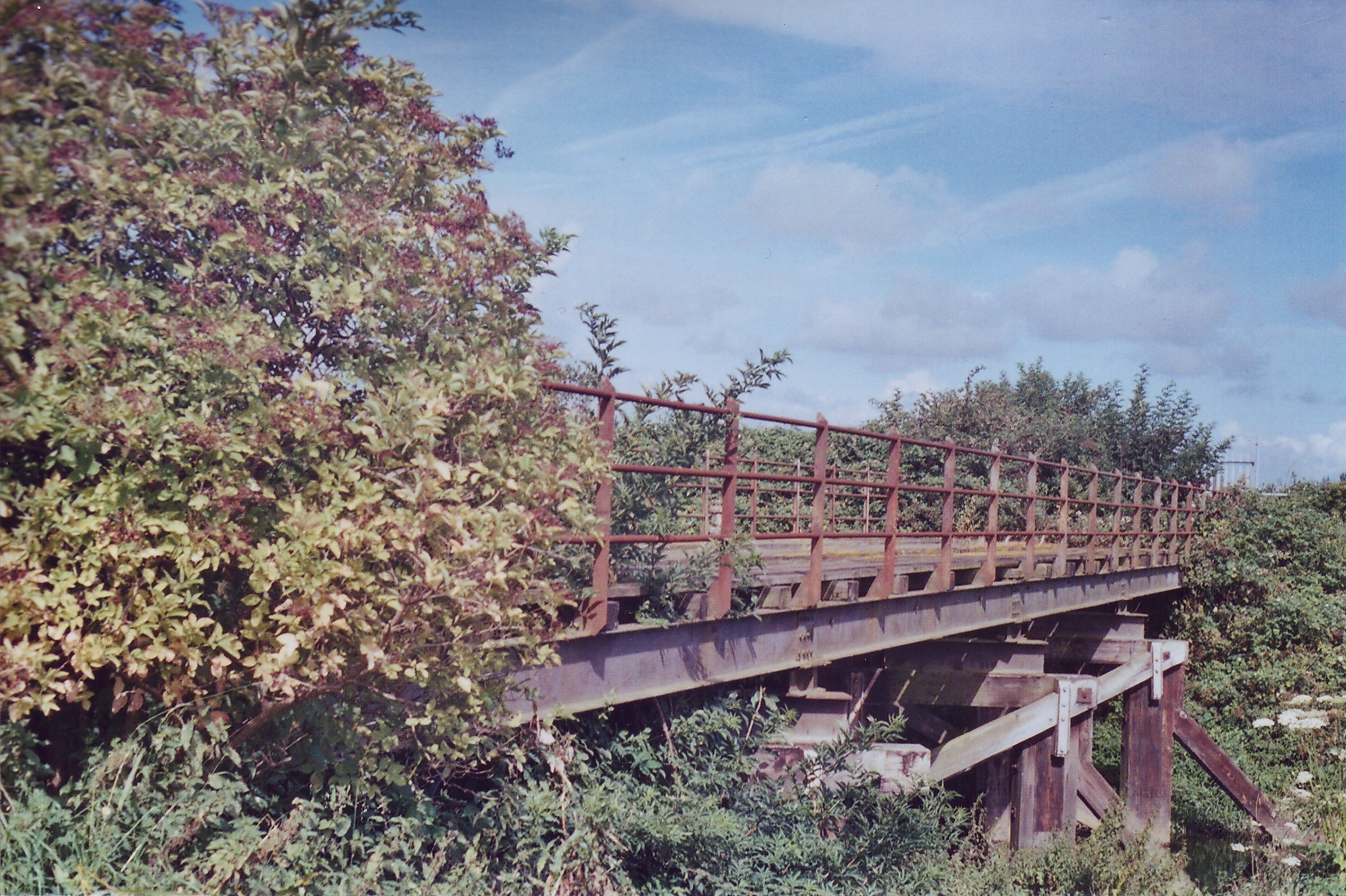
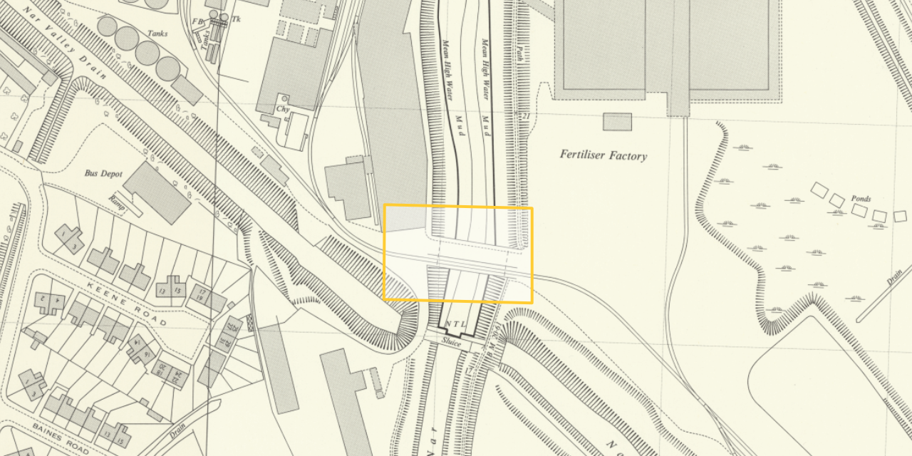
This was a bridge known as the “Casey Jones” bridge over the River Nar. It sat next to the “new” A148 road (the Nar Ouse Way) between the A47 Saddlebow roundabout and the South Gates roundabout.
It got that name because it looked rather like a miniaturised version of a wooden American bridge; the sort of thing you could imagine a steam locomotive with an oversized chimney and cow catcher lumbering over. Someone at some point in time associated “it looks American” with the famous American locomotive driver from the song, and the name stuck among the sort of people who like that sort of thing.
It was of quite charming, rather atypical construction anyway; wooden trusses, with a steel deck, and some very nice steel railings. The girders that made the deck were stamped “Lanarkshire Steel”. This implies that the bridge was rebuilt at some point; Lanarkshire Steel was founded in 1889, post-dating the original construction of the Harbour Branch by about four decades.
It still existed when I first started looking at the history of the railways of King’s Lynn. I took a photo of it on a film camera in 2006. I rather like the way that photographic film subtly brings out all the warm tones just by nature of being film, rather than because I’ve spent fifteen minutes making it look right in a photo editor.
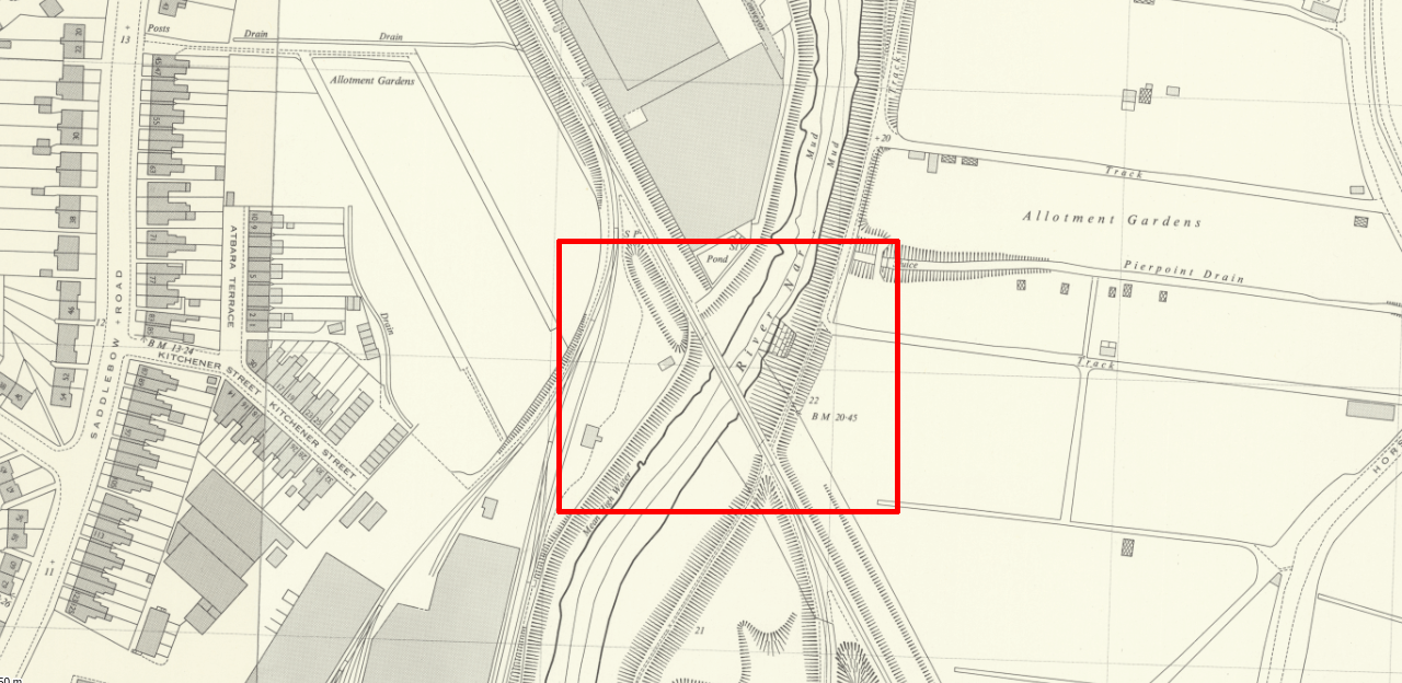
This bridge was part of the Harbour Branch in King’s Lynn. You can see it in the map below.
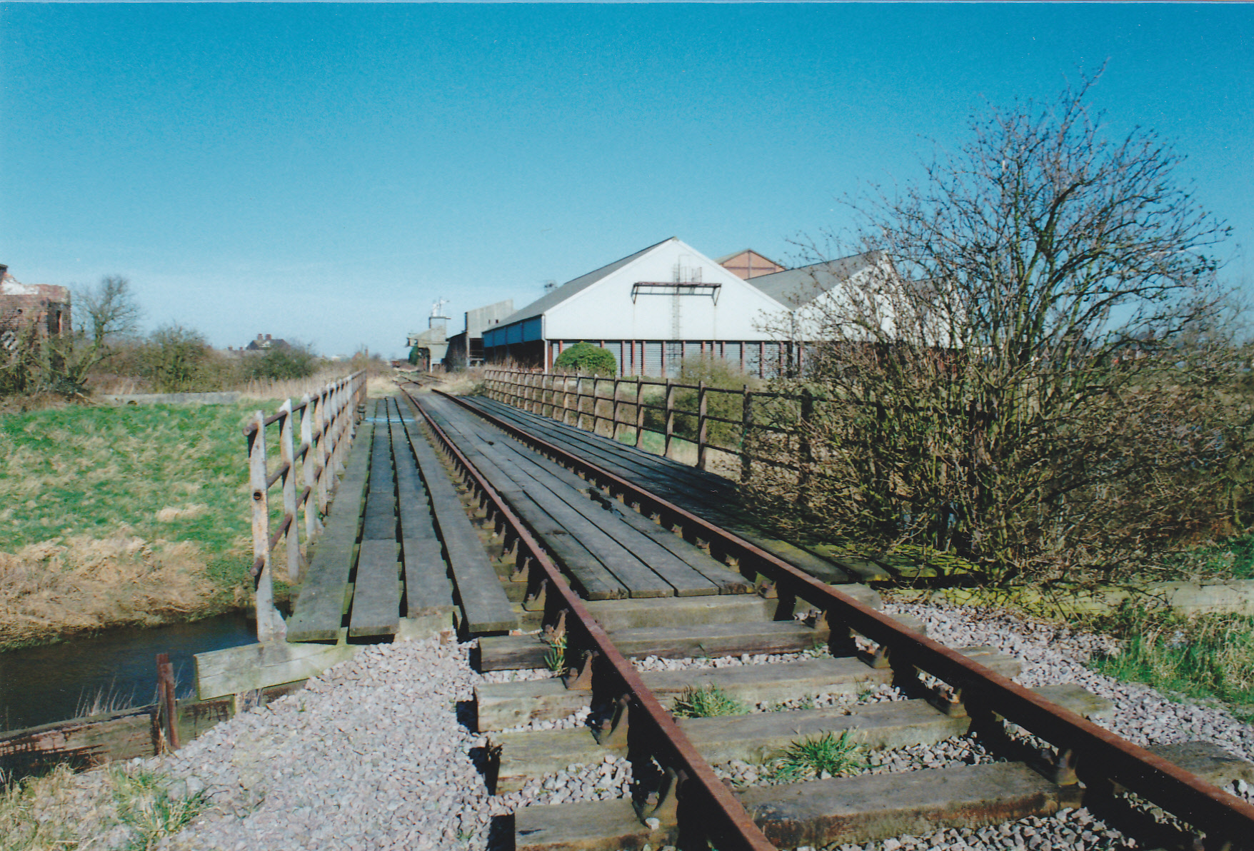
The Harbour Branch was truncated to Wisbech Road in the 1960s, no longer serving the harbour, but the remaining stub of the line stayed in use for grain storage and assorted activities on the stub of the line until the 1990s. You can see it with the rails in place in the 1994 photo below by Nick Youngman, with some of the industrial buildings it served in the background.
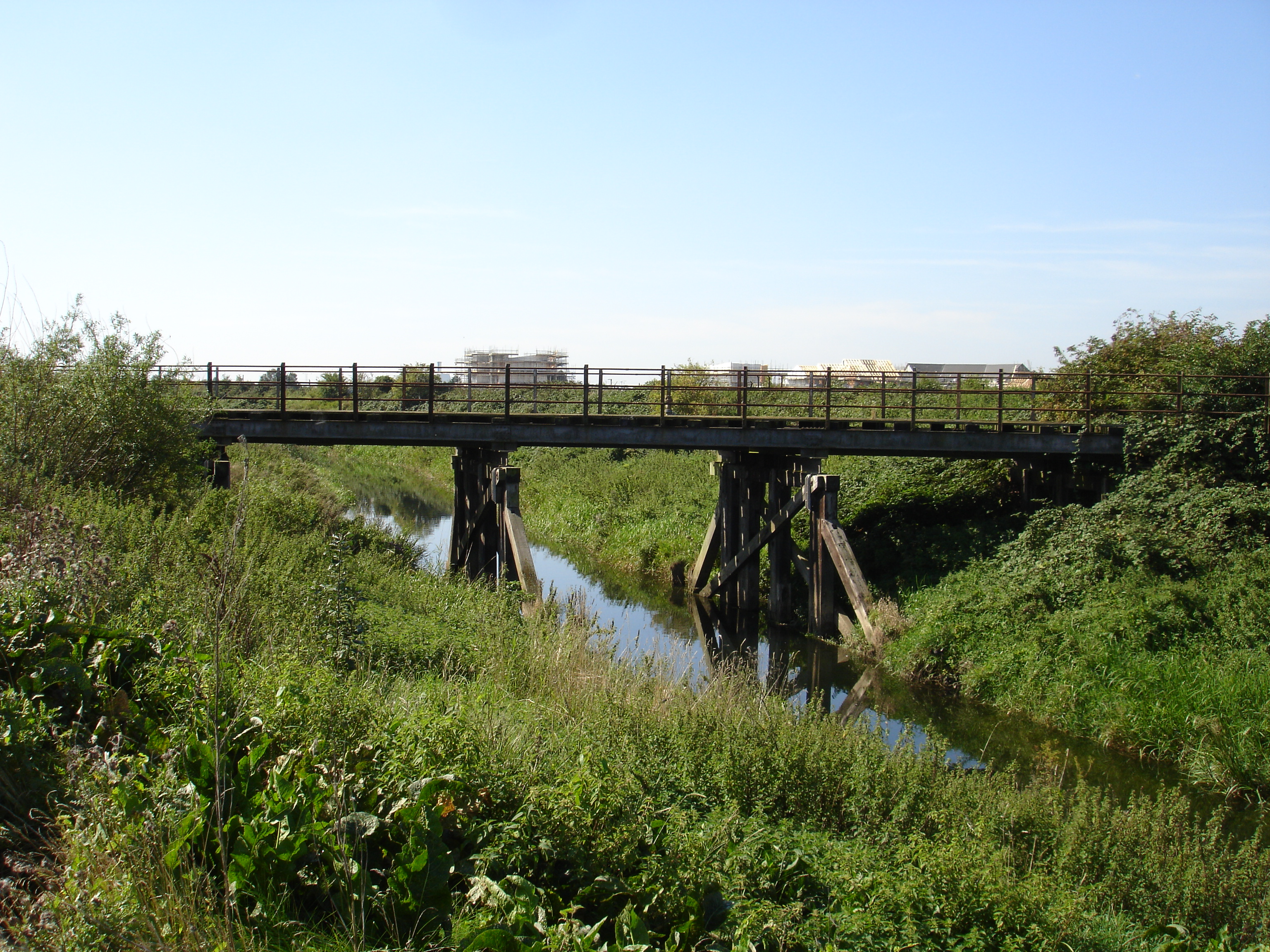
Those buildings are now a housing estate. Today there is a footbridge at almost exactly this location, linking the housing estate to the new commercial developments on the other side of the river; I think it’s a very pleasant bridge that has aged quite well.
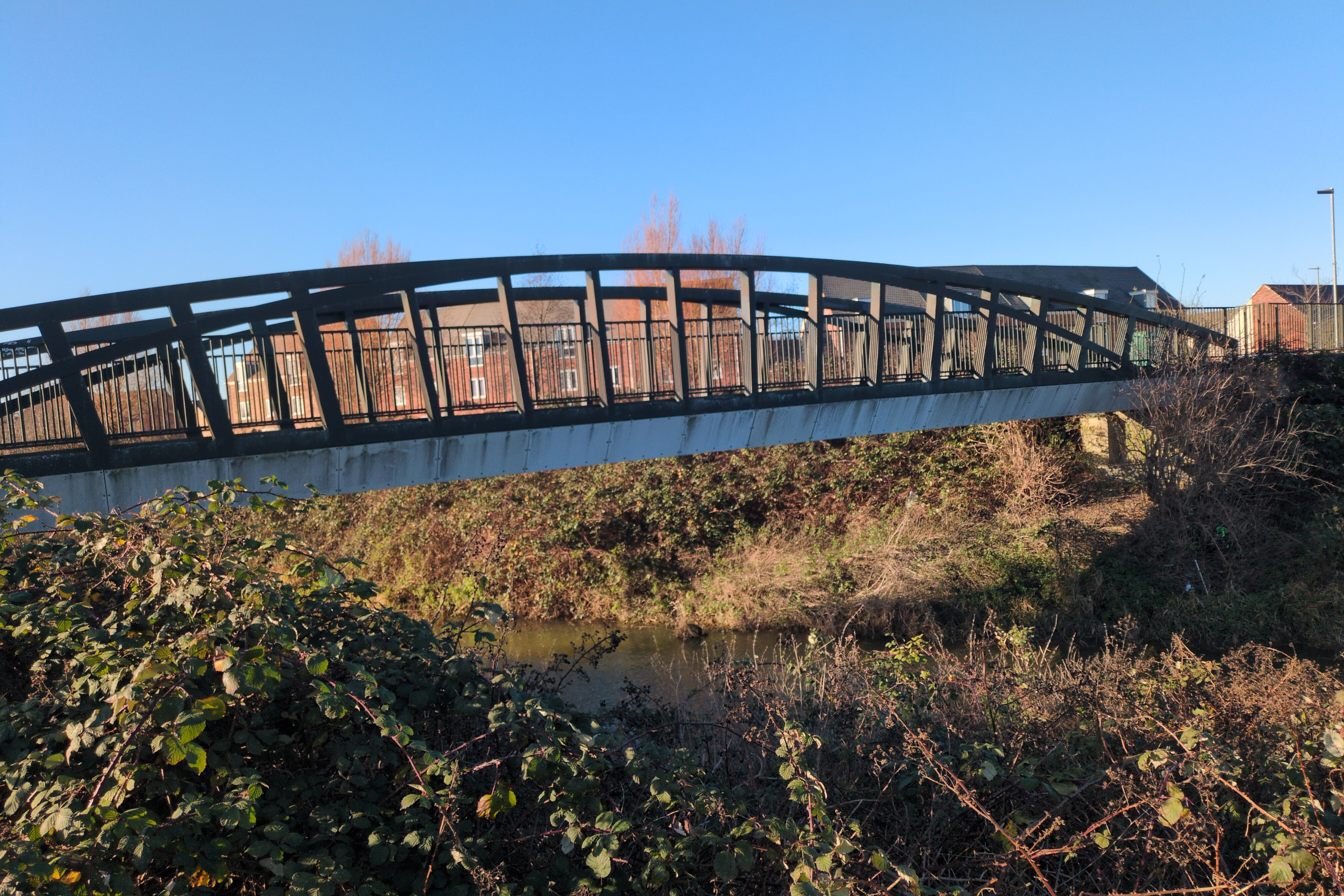
I said “almost” above; the location is so close that it’d be easy to think it in the same place. But the new one is a few meters downstream from where the Casey Jones bridge was. For a short time, both bridges existed side-by-side as this (small) photo shows.
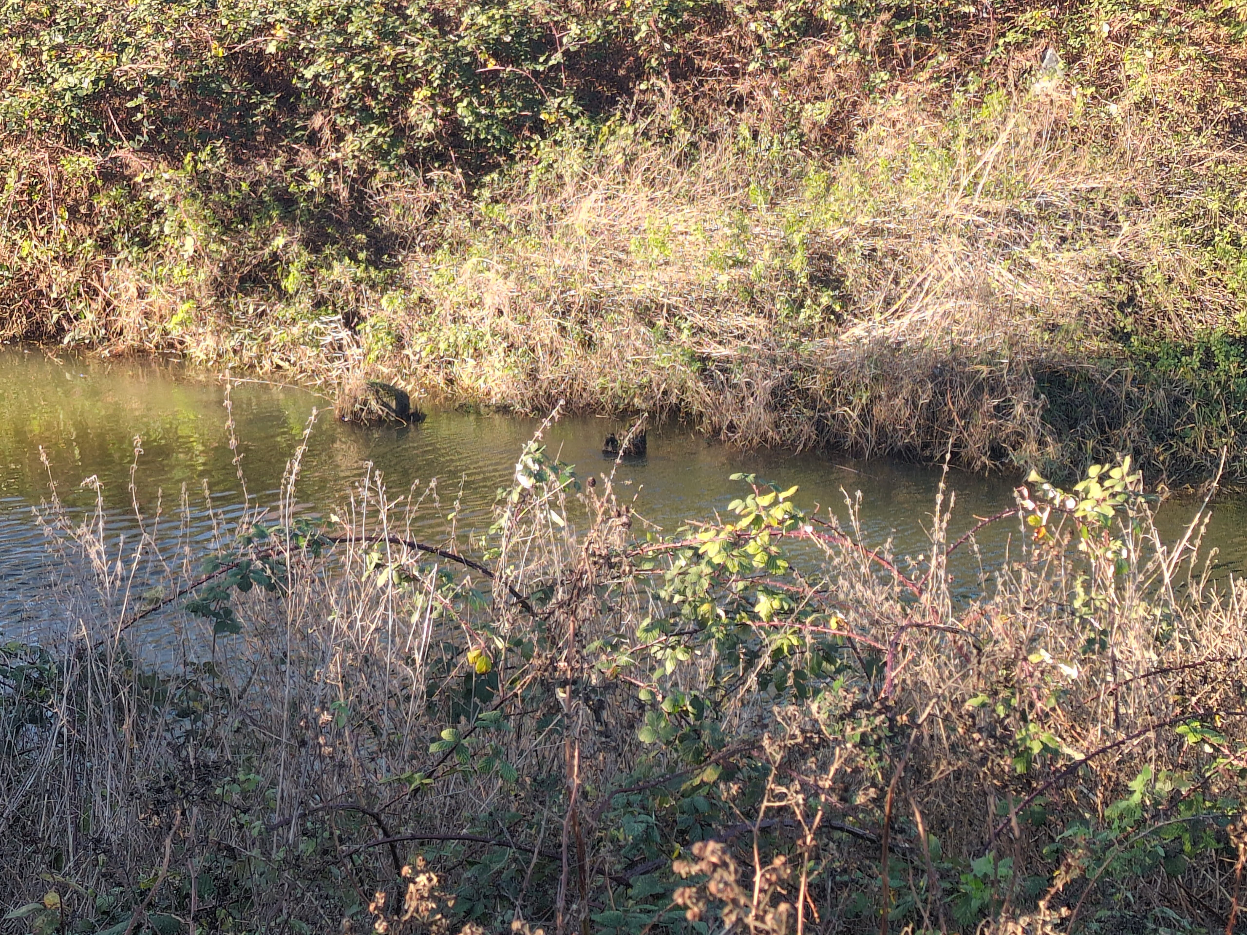
The Casey Jones bridge was deemed unsafe, and was demolished shortly after the construction of the footbridge next to it. No trace of it remains. There are these pilings in the water right next to the current bridge…
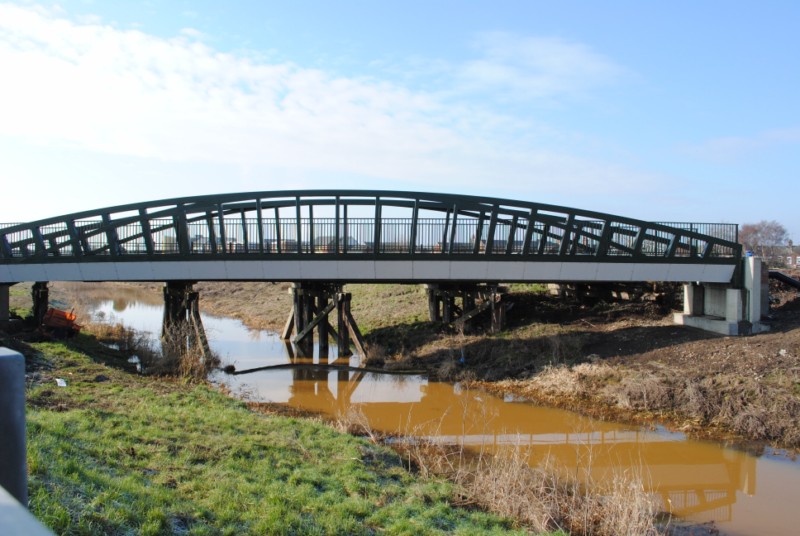
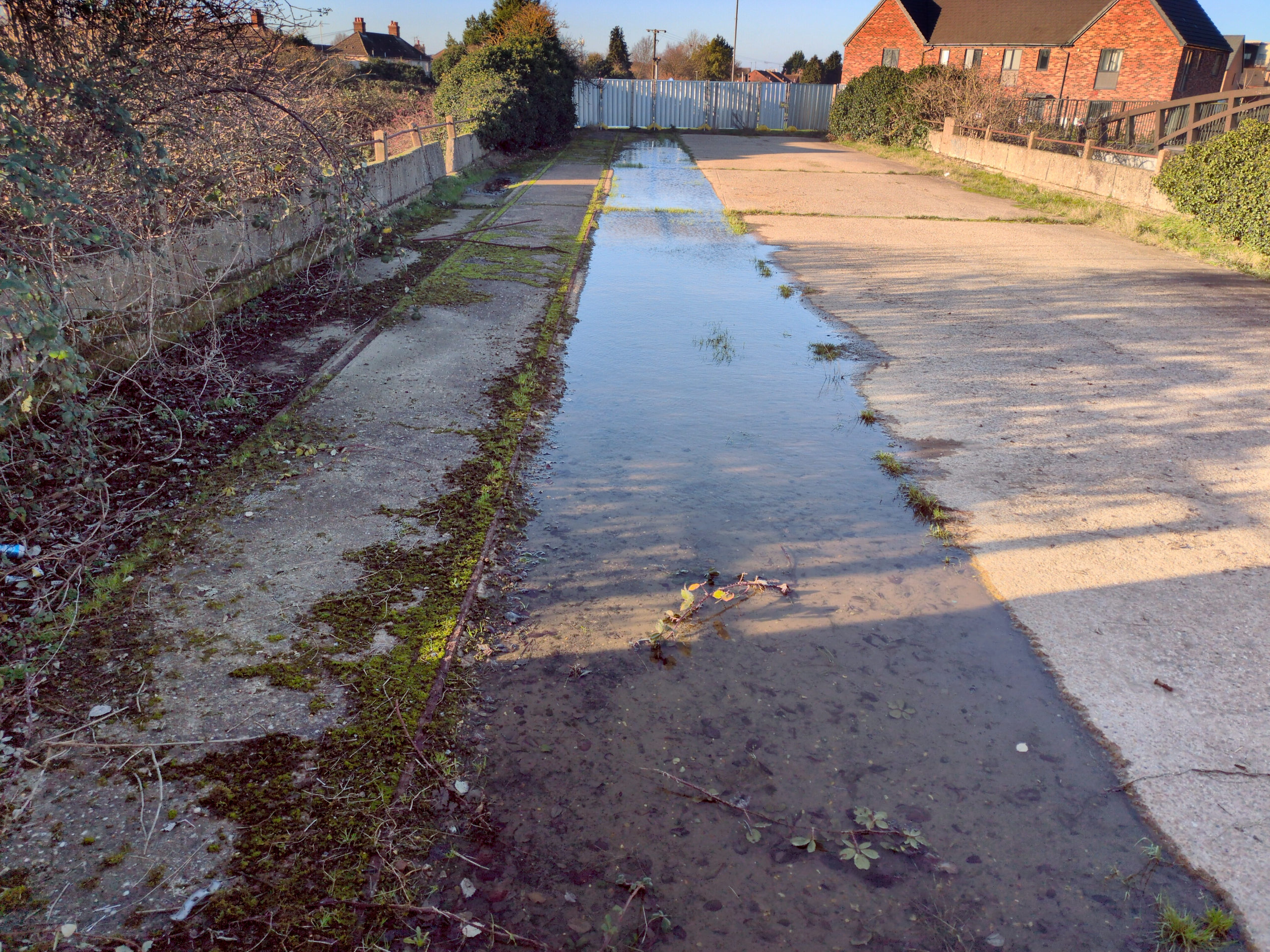
…but their location is a few metres downstream of the location of the Casey Jones bridge, and they’re of the wrong size anyway. Instead, 360 metres downstream (south) we have this survivor, brought to my attention by Alex Brammer. It’s easy to get to, because of the works done to make the east bank of the Nar pedestrian-friendly in this area. It was scheduled to be demolished, having being replaced for pedestrian use by a steel bridge near-identical to the one built next to the Casey Jones bridge.
It shows up on maps as being part of the network of sidings around the Muck Works.
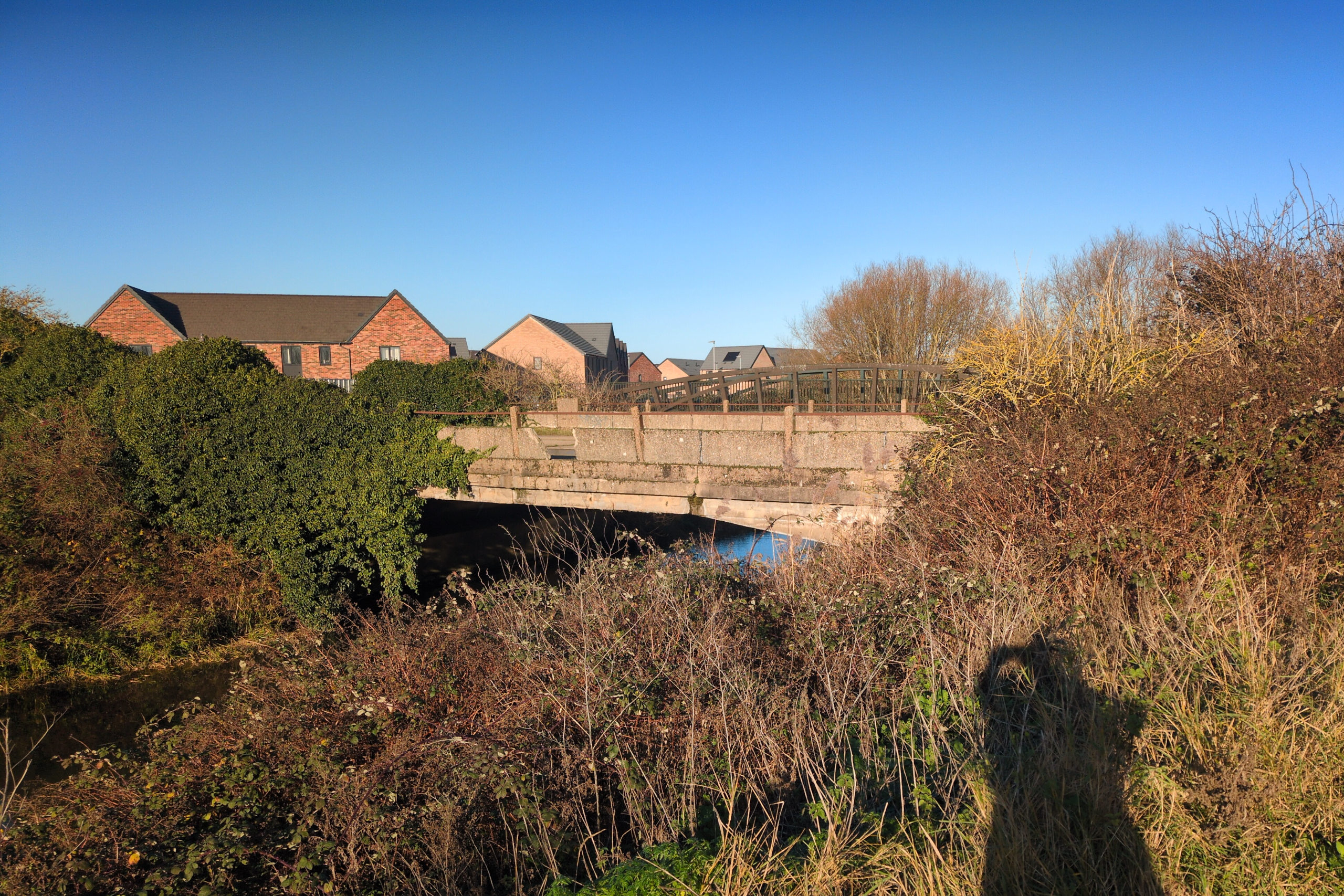
Why it was scheduled to be demolished is clear from looking at it; parts of it have fallen into the water, and the rest has huge cracks. Why it was not demolished is unclear. But a look over the security fencing shows that rails are still present on the bridge!
Further reading
- More on the Harbour Branch by Norfolk’s Disused Railways.
- Even more on the Harbour Branch by Roger Farnworth.